
Preview


Description
Leader GPS – Your Trusted Outdoor Companion Whether you are on the winding National Highway 318 or the mysterious National Highway 219, Leader GPS is always by your side, guiding you on your way. Leader GPS is a versatile app designed for outdoor enthusiasts, integrating altitude measurement, precise GPS positioning, and more. With it, you can easily check the altitude of your current location and stay oriented on your journey. Whether you are hiking, cycling, or driving, it helps you access your current altitude, air pressure, oxygen level, and latitude and longitude coordinates. Key Features: • Real-time altitude measurement: Accurately check the altitude of your current location, ideal for outdoor activities with significant elevation changes, such as mountaineering and hiking. • GPS positioning: Quickly obtain your accurate location to avoid getting lost and easily handle complex road conditions. • Display air pressure and oxygen level: Check the data anytime to supplement oxygen and prevent altitude sickness. Use Cases: • Road trips: When traveling to high-altitude plateau regions, it displays your altitude in real time, helping you calmly manage altitude sickness. • Outdoor adventures: Whether you are hiking in the mountains or crossing the desert, Leader GPS is an essential tool that keeps you from getting lost. • Cycling enthusiasts: Provides full-route GPS coordinates and real-time altitude data to support long-distance cycling. Start your outdoor adventure now and never lose your way!
What's New
Version 1.3 2026-11-17
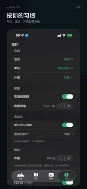
This update makes tracking more accurate and lets you see the path you’ve taken more clearly. [New] Full-screen route map: Tap the map during a recording to zoo...This update makes tracking more accurate and lets you see the path you’ve taken more clearly. [New] Full-screen route map: Tap the map during a recording to zoom in and view it. A persistent info card in the lower-left corner shows distance, elapsed time, speed, elevation, and ascent at a glance. Language, units, and appearance can follow the system: By default, the app reads your system settings. On an English system, it automatically uses feet and miles, but you can also lock it to your preferred settings. After a recording ends, the number of route points for this session is displayed. If there are fewer than two route points, you’ll be clearly told that the recording was not saved, rather than being silently discarded. Dynamic Island: Displays your speed, elevation, and other information in real time. Technical Analysis
Package Overview Basic metadata
Bundle ID
com.panjing.altimeter Current Version 1.3
Minimum iOS 18.0
Package Size App Store Size
Package Metadata 1 / 2 version records
Detailed binary, privacy manifest, framework, and Info.plist results have not been indexed for this package yet. The verified App Store and archive metadata above remains available.
Developer Information
Known Version Records
1 version record with stored package metadata • 2 known version records
Stored metadata does not guarantee a package is currently available to download.
| Details | Version / IDs | Version date | Action |
|---|---|---|---|
| 37.56 MB | v1.1 App Store ID: 876701868Build: 1.1 | 2025-07-25 16:48:35 | Paid / Arcade |
| Not archived | v1.0 App Store ID: 869585619Build: 1.0 | 2024-10-24 16:52:32 | Paid / Arcade |