
Preview




Description
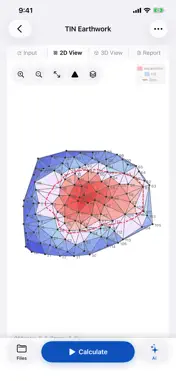
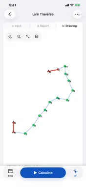
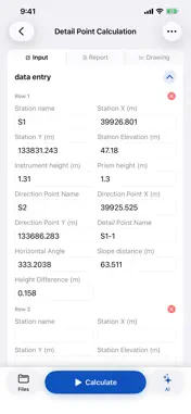
ESDPS is a professional engineering surveying app for field calculation, road staking, earthwork quantity computation, and project review. Key features: 1. Curve staking: supports straight line staking, circular curves, vertical curves, virtual-focus curves, three-point curves, S-curves, egg-shaped curves, compound curves, comprehensive curves, combined alignments, interchange ramp curves, and full-line layout by intersection points. 2. Basic surveying: supports coordinate forward and inverse calculation, Gauss projection conversion, zone conversion, coordinate transformation, forward intersection, side intersection, resection, area calculation, map sheet calculation, and detail point calculation. 3. Earthwork calculation: supports grid earthwork, TIN earthwork, cross-section earthwork, and contour-based earthwork calculation. 4. Survey adjustment: supports closed traverse, connecting traverse, branch traverse, undefined traverse, closed leveling, connecting leveling, and branch leveling. 5. Topographic and drawing tools: supports contour drawing and DWG/DXF file viewing. 6. Point cloud tools: supports LiDAR point cloud scanning, point cloud processing, and browsing PLY, OBJ, LAS, and other point cloud files. 7. File management: supports local project saving, search, opening, renaming, cloud upload, download, and synchronization. 8. AI assistant: helps query local or cloud project files, explain surveying module parameters, recognize images, tables, and documents, and assist with common engineering surveying questions. ESDPS is designed for engineering surveying, road construction, topographic mapping, earthwork checking, field staking, and project file management. The free version provides basic access, while signed-in users can upgrade in the plan center for cloud, AI, and full-feature access. website:http://www.esdps.cn Terms of Use: https://www.apple.com/legal/internet-services/itunes/dev/stdeula/
Technical Analysis
Package Overview Basic metadata
Bundle ID
cn.esdps.app Current Version 1.0
Minimum iOS 17.0
Package Size App Store Size
Package Metadata 0 / 0 version records
Detailed binary, privacy manifest, framework, and Info.plist results have not been indexed for this package yet. The verified App Store and archive metadata above remains available.
Developer Information
Known Version Records
0 version records with stored package metadata
Stored metadata does not guarantee a package is currently available to download.
| Details | Version / IDs | Version date | Action |
|---|