
Preview


Description
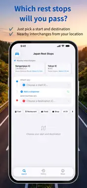
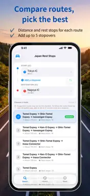
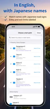
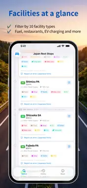
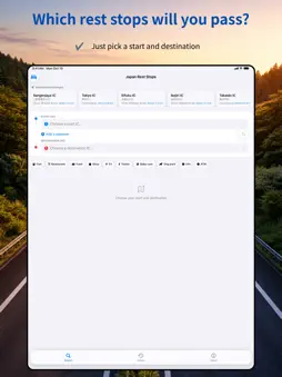
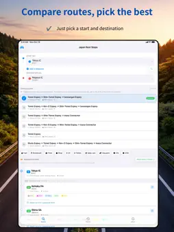
Wondering which rest stops you can visit on a Japanese expressway drive? どのSA通る? ("Japan Rest Stops" in English) lists every service area (SA) and parking area (PA) along your route. Just choose a start and destination interchange (IC). It covers the NEXCO expressways as well as the Shuto Expressway in Tokyo and the Hanshin Expressway in Osaka and Kobe. KEY FEATURES - Simple route search Choose a start and destination IC, and add stopovers if you need to. ICs, junctions (JCT), SAs and PAs are grouped by road, and places where roads meet appear under every road they belong to. Names are shown in English letters together with the Japanese name, so you can match them with road signs, and you can search in English or Japanese. - Entry and exit directions Entry-only and exit-only interchanges, and interchanges that connect in one direction only, are labeled (for example, "Entry / exit toward Osaka only"). Routes that would use a direction you cannot enter or exit are not shown, and if no route is found, the app tells you why. - Multiple route options For the same start and destination, the app suggests several routes, such as via the Tomei or Shin-Tomei Expressway, so you can compare distances and the number of rest stops. - Facility filters Filter rest stops by 10 types of facilities, including fuel, restaurants, EV charging, dog parks and baby care rooms. If stops are hidden because their facilities have not been recorded yet, the app tells you how many. - Rest stop details See each stop's facilities at a glance, with links to official pages from NEXCO, the Shuto Expressway, the Hanshin Expressway and other operators (mostly in Japanese). Stops that serve only one direction are marked and hidden on routes going the other way, and facilities found on one side only are shown like "Fuel (Outbound only)". - Suggested breaks Rest stops close to every two hours of driving (or every 1 or 1.5 hours, or off) are highlighted along your route to help you plan breaks on long drives. Break intervals assume an average speed of 80 km/h. - History and quick swap Your recent routes are saved automatically, and one tap swaps the start and destination for the trip home. COVERAGE 2,404 places, including 476 rest stops, on 155 roads across Japan: NEXCO expressways such as the Tomei, Shin-Tomei, Meishin, Chuo, Tohoku and Sanyo Expressways; the Shuto Expressway (25 routes); the Hanshin Expressway (15 routes); the Nagoya Expressway; the Tokyo Bay Aqua-Line; the Shimanami Kaido; and more. Route search works offline with the built-in data, and no account is required. Locations, distances and facility information are compiled from publicly available information, including information published by the expressway operators. No operator trademarks, logos or content are used. Data sources are listed in the app under About > Sources and licenses. The data is updated regularly. If you notice an error, please let us know with "Report an error" on each rest stop, through the contact form in the app (both forms are in Japanese), or in a review.
What's New
Version 1.0.8 2026-10-20
Entry and exit directions We registered 447 interchanges nationwide that are entry-only, exit-only, or connect in one direction only. They are labeled when you ... Technical Analysis
Package Overview Basic metadata
Bundle ID
com.techemo.dono-sa-tooru Current Version 1.0.8
Minimum iOS 18.1
Package Size App Store Size
Package Metadata 0 / 3 version records
Detailed binary, privacy manifest, framework, and Info.plist results have not been indexed for this package yet. The verified App Store and archive metadata above remains available.
Developer Information
Known Version Records
0 version records with stored package metadata • 3 known version records
Stored metadata does not guarantee a package is currently available to download.
| Details | Version / IDs | Version date | Action |
|---|---|---|---|
| Not archived | App Store ID: 886947869 | Unknown | Request Version |
| Not archived | App Store ID: 886863158 | Unknown | Request Version |
| Not archived | App Store ID: 883198679 | Unknown | Request Version |