
Preview




Description
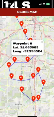
MissionNAV is a professional field-navigation app for hiking, search and rescue, hunting, surveying reference, emergency preparedness, geocaching, and outdoor operations. Navigate with accurate GPS position data and view your location in MGRS, USNG, UTM, OSNG, latitude/longitude decimal degrees, degrees-minutes-seconds, and degrees-decimal-minutes. Convert coordinates, copy or share them, create waypoints, and open locations on the map. Use the navigation compass to track bearing and distance to a selected waypoint. View target direction, current heading, speed, altitude, GPS accuracy, course, and estimated travel information. Optional haptic feedback helps indicate when you are aligned with your target. Create waypoints from your current GPS position, manual coordinate entry, map center, long-press map placement, or distance-and-bearing projection. Rename, edit, favorite, duplicate, reorder, organize, and delete waypoints. Group locations into overlays such as Home, Hiking, Emergency, Survey, or Mission, with visibility controls, custom icons, and colors. The Field Map provides standard, satellite, and hybrid map styles, user location tracking, waypoint markers, a fixed center targeting reticle, coordinate display, and map-based waypoint creation. Measure distance and bearing between locations and quickly purge all saved waypoints when needed. Import and export waypoint data using GPX, KML, CSV, and MissionNAV JSON backups. Share individual waypoints or your complete waypoint dataset using the native iOS share sheet, including AirDrop, Messages, Mail, Files, and iCloud Drive. Customize the Dashboard and Navigate screens with reorderable data panels, adjustable font sizes, unit preferences, and multiple display presets. Choose metric, US/Imperial, or both units for distance, speed, and altitude. Personalize the experience with Tactical Green, Amber Night, Ocean Blue, High Contrast, and daylight-friendly display options. MissionNAV stores waypoint data locally and core navigation features work without an account or subscription. GPS-dependent readings are clearly identified and are never fabricated when unavailable.
What's New
Version 1.5.4 2026-10-15
- Added customizable color themes with consistent accent and data colors. - Added metric, US/Imperial, or combined unit display options. - Added adjustable font... Technical Analysis
Package Overview Basic metadata
Bundle ID
com.yourfullstack.tacticalnav Current Version 1.5.4
Minimum iOS 15.6
Package Size App Store Size
Package Metadata 0 / 3 version records
Detailed binary, privacy manifest, framework, and Info.plist results have not been indexed for this package yet. The verified App Store and archive metadata above remains available.
Price History (USA store)
3 recorded price change points. These are historical observations, not a guarantee of the current price.
| Recorded at | Price | Currency |
|---|---|---|
| 8.99 | USD | |
| 0.0 | USD | |
| 8.99 | USD |
Developer Information
Known Version Records
0 version records with stored package metadata • 3 known version records
Stored metadata does not guarantee a package is currently available to download.
| Details | Version / IDs | Version date | Action |
|---|---|---|---|
| Not archived | App Store ID: 870640065 | Unknown | Paid / Arcade |
| Not archived | App Store ID: 870462460 | Unknown | Paid / Arcade |
| Not archived | App Store ID: 870222394 | Unknown | Paid / Arcade |