Description
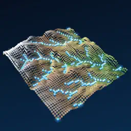
Point Hydrology Simulator is a 3D hydrology lab that runs on your device's GPU. Real terrain becomes a living point cloud: rain falls on every cell, soaks in or runs off, gathers into streams and rivers, floods valleys and recharges the groundwater, all in front of you, from any angle. REAL TERRAIN Start in a Rocky Mountain catchment above Boulder, Colorado. With Pro, open a Himalayan valley at Kedarnath, the urban floodplain of Ellicott City, the Mississippi delta, or search any place on Earth and simulate a square of 1 to 40 km from real elevation data (USGS 3DEP, SRTM and other open datasets). Or sculpt your own synthetic valley. RAIN, SOIL AND RUNOFF Set rain intensity and duration, or (Pro) use SCS Type II and Chicago design storms for a chosen return period and send a storm cell across the map. Water infiltrates with the Green–Ampt model for 11 soil textures, or with the SCS Curve Number method. Land cover sets surface roughness, imperviousness and canopy interception; paint forest, fields or city onto the terrain and see the hydrograph change. FLOODS AND RIVERS The full 2D shallow-water equations are solved with a well-balanced finite-volume scheme that handles wet and dry ground, fast flood waves and dam breaks. A faster local inertial mode suits slow floodplain flow. Colour the water by depth, velocity, maximum depth or Froude number, and follow glowing flow particles down the channels. GROUNDWATER AND EROSION (PRO) An unconfined aquifer is recharged by infiltration and seeps back into valleys as baseflow. Optional bedload transport shows where channels erode and bars build up. GAUGES AND HYDROGRAPHS Watch rainfall and outflow plot live, with peak discharge, time to peak and the runoff coefficient. With Pro, drop gauges on rivers to record stage and discharge, and export everything as CSV or record a video. HONEST SCIENCE Every method is cited in the app. A built-in validation suite checks the solver against analytical solutions (Ritter and Stoker dam breaks, Thacker's oscillating basin, the kinematic-wave plane, Green–Ampt, the Dupuit–Thiem well) and conservation laws, and you can run it on your own device. A live water balance shows the closure error. Point Hydrology is an educational and planning-exploration tool, not for engineering design, flood warning or emergency decisions. APPLE VISION PRO Put the watershed on your table as a volume and walk around it while the storm passes. POINT HYDROLOGY PRO Free: the Rocky Mountain preset and synthetic terrain, constant rain, infiltration and surface flow at Low and Medium resolution. Pro adds any location, all presets, groundwater, erosion, design and moving storms, gauges with CSV export, High and Ultra resolution and video export. Monthly ($2.99) or yearly ($19.99, 7-day free trial) subscriptions, or a one-time lifetime unlock ($39.99). Orchestr Education also unlocks Pro here and in other Orchestr education apps. Terms of Use: https://www.apple.com/legal/internet-services/itunes/dev/stdeula/ Privacy Policy: https://gist.github.com/wonmor/e97bea94d563cceb0bdd63fb19049f0e
Technical Analysis
Package Overview Basic metadata
Bundle ID
com.orchestrsim.pointhydro Current Version 1.0
Minimum iOS 2.0
Package Size App Store Size
Package Metadata 0 / 0 version records
Detailed binary, privacy manifest, framework, and Info.plist results have not been indexed for this package yet. The verified App Store and archive metadata above remains available.
Known Version Records
0 version records with stored package metadata
Stored metadata does not guarantee a package is currently available to download.
| Details | Version / IDs | Version date | Action |
|---|