
Preview






Description
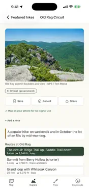
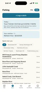
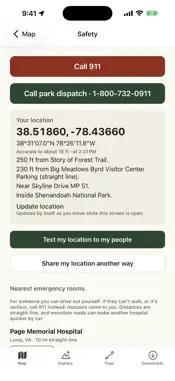
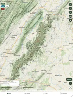
Mossback is a hiking and fishing planner with offline maps for more than 5,000 hikes across 71 national parks, national forests, state parks and wildlife areas. From Yosemite, Zion, Glacier, Yellowstone, the Grand Canyon, Acadia and the Smokies to the forests and state parks of Virginia and West Virginia, every area works without cell service once it's on your phone, so your plan still works when your signal drops at the trailhead. FIND EVERY HIKE • Real hikes from real trailheads: the classics, the loops, the backpacking circuits and the sections people actually do, plus the named trails around them • Places with several routes show them side by side • Find a hike: waterfalls, views, summits, swimming holes, caves, fire towers, history, camping, loops, scrambles, quiet trails, dogs and kids, sorted by the closest drive, the best match or the best overall • Every hike says whether dogs are allowed and whether it is accessible, in the managing agency's own words BUILD MY HIKE • Pick what you want to see, like a waterfall, a view and a swimming hole, and get real hikes on real trails • Choose a loop or an out and back, a length and a climb limit, with or without your dog • Honest answers: if no one hike has it all, it says so and shows the closest ones • Plan an overnight: it finds a real hut, shelter, cabin or campground and splits the miles between days PLAN A HIKE YOU CAN FINISH • Tap waypoints and the route follows the trails, with distance, climb and time • "Can I finish before dark?" and door to door timing with Apple Maps drive time • Know before you go: permits, tickets and lotteries, closed roads and trails, dog rules, busy trailheads, scrambles, hunting seasons in all 50 states and weather hazards • Rain radar, and storm mode when a severe weather alert covers your hike • Water on the way, junctions, best time of year, a packing list from the forecast, and when it's dark enough for stars NAVIGATE ON THE TRAIL • A lock screen card with your next turn, miles left, the climb to the next top, climb and descent left, an elevation profile and a map of your route, with Pause and SOS • Off course and turnaround alerts, plus the next water and next junction • Trail difficulty colors and slope steepness shading on the map, where available • Pause turns GPS off to save battery, and Stop for camp holds your trip overnight STAY SAFE • Text your plan to your people in one tap, with when to call for help, and "back safe" when you're done • SOS: your coordinates, trail, nearest lot, and the ranger, sheriff and ER for where you are, all without signal FISHING MODE • Fishing spots across the parks and forests, each with its license and limits • Tides, live water temperature and trout stocking where states publish it • Feeding windows, solunar times, a hatch chart, species ID, knots and eating advisories • Log every catch with the bait or lure that worked RECORD AND LEARN • Record hikes with GPS, even locked, and see every hike you've done on the map • Continue a hike you ended by mistake, and see each night of a camping trip • Save hikes, earn badges, share a picture and watch your stats grow • Import and export GPX, and export all your data WORKS OFFLINE • Download a whole park or forest in one tap, or a district, your saved hikes or a square on the map, and nothing downloads twice • Four map styles: Hiking, Topo, Satellite and USGS Topo • Everything but live weather, radar, gauges, water temperature, stocking and hike photos works with no signal PRIVATE BY DESIGN • No account, no ads, no analytics, no tracking • Your pins, hikes and camp spots save to your own iCloud, private to you, and you can turn that off in Settings Rules and safety information are for reference only. Always check current conditions and official sources. Mossback is not affiliated with the National Park Service, the U.S. Forest Service or any state agency.
What's New
Version 1.3.2 2026-11-01
The lock screen card while you follow a route is new. It shows your next turn, the miles left and when you will be done, the climb to the next top, the climb an... Technical Analysis
Package Overview Basic metadata
Bundle ID
com.sasha.mossback Current Version 1.3.2
Minimum iOS 16.4
Package Size App Store Size
Package Metadata 0 / 0 version records
Detailed binary, privacy manifest, framework, and Info.plist results have not been indexed for this package yet. The verified App Store and archive metadata above remains available.
Known Version Records
0 version records with stored package metadata
Stored metadata does not guarantee a package is currently available to download.
| Details | Version / IDs | Version date | Action |
|---|