
Preview






Description
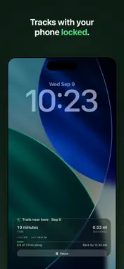
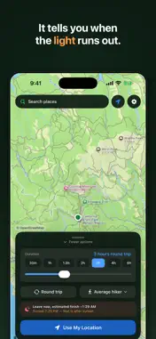
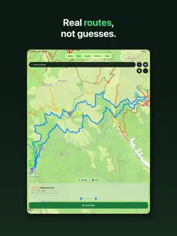
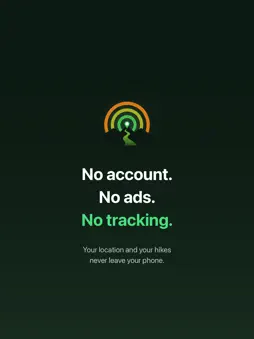
You have three hours before you need to be back. What can you actually hike? TrailTime answers that one question. Drop a pin, set your time, and the map lights up with every trail you can reach and still get back from before your time runs out. Not a circle drawn on a map. Real trails, real elevation, and an honest model of how fast people actually walk uphill. PLAN BY TIME, NOT DISTANCE Drag the time slider and the map repaints as you move it. Green trails are close. Orange trails will take everything you've got. When the shape looks right, TrailTime pulls out real routes: loops and out-and-backs with distance, climbing, difficulty, and the viewpoints, lakes, and waterfalls they pass. SET YOUR OWN PACE A slider covers everyone from a slow wander with the kids to a full trail run. And once you've recorded 25 miles of real hiking, Summit can plan with your own measured pace instead of a guess. RECORD YOUR HIKES Hit start and put your phone away. Distance, pace, and elevation keep recording with the screen locked, and live stats sit right on your Lock Screen. If the app gets killed mid-hike, your recording is saved. Finished hikes can go straight to Apple Health. BACK BEFORE DARK (Summit) Planning an afternoon out? TrailTime checks the daylight at your trailhead and tells you plainly: back by 5:50 PM, about 40 minutes before sunset. WORKS WITH NO SIGNAL Everything is computed on your phone, not on a server. Saved routes download their trail data, so you can plan and navigate in places where your phone says No Service. PRIVATE, FOR REAL No account. No ads. No analytics. Your location and your hikes never leave your phone. The privacy policy is short enough to actually read. FREE AND SUMMIT The reach map, route planning, and hike recording are free. Summit adds: • All-day plans up to 8 hours • Unlimited plans and saved routes • Offline routes • Daylight planning with sunset warnings • GPX export to Garmin, Gaia, and your watch • Your measured pace, scenic route ranking, and pace analysis Summit is $3.99 a month or $29.99 a year, and the yearly plan starts with a free week. Prices may vary by region. Subscriptions renew until cancelled and can be managed anytime in your App Store settings. A NOTE FROM THE DEVELOPER I'm Bill, and TrailTime is a one-person project. I built it because every hiking app could tell me where trails were, but none could answer the question I actually had: I've got until 4, what can I do? Trail data comes from OpenStreetMap, and coverage grows every month. If your favorite area is missing, email me at [email protected] and I'll move it up the list. Terms of Use: https://www.apple.com/legal/internet-services/itunes/dev/stdeula/
What's New
Version 1.1 2026-09-12
- Improved hike/run tracking - Bug Fixes - Improved UI - Better Functionality Technical Analysis
Package Overview Basic metadata
Bundle ID
com.bilk.HikingIsochrone Current Version 1.1
Minimum iOS 17.0
Package Size App Store Size
Package Metadata 0 / 0 version records
Detailed binary, privacy manifest, framework, and Info.plist results have not been indexed for this package yet. The verified App Store and archive metadata above remains available.
Known Version Records
0 version records with stored package metadata
Stored metadata does not guarantee a package is currently available to download.
| Details | Version / IDs | Version date | Action |
|---|