
Preview




Description
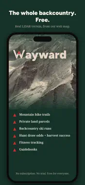
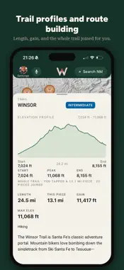
Wayward GPS is a free GPS map for the backcountry — one map that shows what the land is doing, who owns it, and what the sky is doing, so you can plan your own way out there. THE MAP • High-resolution terrain — some of the sharpest elevation data published, rendered in 3D with peaks that look like peaks • Private land ownership at the parcel line, with owner names where records provide them • Corner-crossing and landlocked-public-land layers to help you see where public meets public • GMU boundaries, wilderness areas, roadless areas, and USFS/BLM roads • Offline maps state by state — trails, parcels, lakes, roads — downloaded to your phone before you lose signal FISHING • Wetfoot Stream Access — stream segments of interest to anglers, drawn as robin's-egg "trout highways" (1 CFS and up), with flow data. Coverage varies, access rules vary, and records can be wrong — confirm before you go. • Tap any river for its story, plus flow and water temperature from USGS gauges when available • Stocking records where the state wildlife agency reported stocking in the last two weeks, with species counts • Whitewater and float runs with class ratings, put-ins, and take-outs TRAILS & RIDING • Thousands of trails with difficulty ratings and honest two-sentence writeups drawn largely from community data • Hike/Run and Bike modes with curated bikepacking routes • Record your tracks, then share them as clean stat cards — distance, vertical, difficulty • Plan routes, drop pins, navigate to anything WEATHER • NEXRAD radar — a composite regional view, or tap any radar dome for super-res detail • Lightning strikes that fade over ten minutes, storm cells with hail and rotation data, when the data is available • See active wildfires with perimeters and the firefighting aircraft working them • Wind flow animation, forecasts, and near-surface smoke HUNTING • GMUs, ownership, walk-in access, and terrain built for glassing country in 3D SKIING • Winter mode with terrain relief tuned for reading lines All of it free. No subscription, no paywall, no feature gates. Coverage is state by state and still growing. Information, not protection. Wayward GPS shows you data from public and community sources that can be wrong, coarse, or out of date — it is a planning tool, not a safety device, a warning system, or a substitute for official sources, your own eyes, and your own judgment. Alerts and forecasts may be delayed, incomplete, or absent, especially with no signal. In an emergency, call 911 or use your device's SOS. Built by people who fish, ride, and hunt here. Data from USGS, NHD, USFS, BLM, NOAA/NWS, state wildlife agencies, and adsb.lol.
What's New
Version 1.17 2026-10-22
Ask the map, go offline for real, and read the ground under every route. • Ask the map: tap the microphone and ask in plain words — "a two-hour ride at Gloriet... Technical Analysis
Package Overview Basic metadata
Bundle ID
app.teriscope Current Version 1.17
Minimum iOS 15.5
Package Size App Store Size
Package Metadata 0 / 0 version records
Detailed binary, privacy manifest, framework, and Info.plist results have not been indexed for this package yet. The verified App Store and archive metadata above remains available.
Developer Information
Known Version Records
0 version records with stored package metadata
Stored metadata does not guarantee a package is currently available to download.
| Details | Version / IDs | Version date | Action |
|---|