Preview





Description
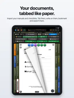
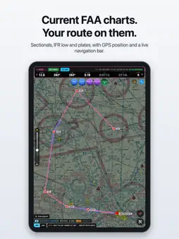
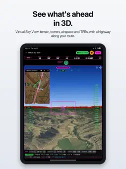
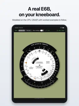
Digital Kneeboard turns your iPad into a kneeboard you build yourself. Your own documents sit in the middle with tabs down both sides, just like paper, and free FAA charts, plates, weather and flight tools are built in around them. No account, no sign-in, no tracking. YOUR DOCUMENTS, TABBED • Import your documents from Files, iCloud or AirDrop, or a whole folder at once. • Up to two rows of tabs on each side. A tab opens a document page, a website, a folder, or a page of buttons. • Start ready to go: named tabs for each phase of flight, plus the AIM and Helicopter Flying Handbook already tabbed by chapter. • Build button pages, hotspots over panel photos. • Build custom caution panels whose lights open the right checklist page. • Write on any page with Apple Pencil, add bookmarks and sticky notes, and search every document. • New edition of a manual? The app finds your tabbed pages in the new one by their words, moves your tabs, bookmarks and ink, and shows what changed. • Keep a kneeboard for each aircraft or mission, and share one with your crew in a single file. • Compare two documents to find what changed. • Maximize the screen view for easy reading. FREE FAA CHARTS AND PUBLICATIONS • Sectionals and IFR Enroute Low charts, joined into one seamless map. • Approach plates, airport diagrams, departures and arrivals, by airport or by state. • Chart Supplement, FAA handbooks, advisory circulars and 14 CFR parts 1, 61, 91 and 135. • Downloaded TAC charts auto display when zooming in on a sectional. • Inverted approach plate toggle. • Charts switch to the new edition on the day it takes effect, never early. Expiring charts turn yellow, expired ones red. • Everything you download works offline. • Next cycle downloads automatically so they're ready to go when the current cycle expires. MOVING MAP AND ROUTES • Georeferenced charts and approach plates, with north-up, track-up and look-ahead views. • Type a route with airports, navaids, fixes, airways or grid coordinates, tap it on the map, or draw it with Apple Pencil. • Leg headings, distance, time and fuel, using your wind or the FAA winds aloft. • A live navigation bar, Direct to, and time on target with the ground speed you need to arrive on time. • Press and hold the map for a hold, airport info, Direct to, an approach plate laid on the chart, or a landing zone of your own. • Airspace you're in, obstacles ahead, current TFRs, and NOAA weather radar on the map. • Import MBTiles formatted maps. VIRTUAL SKY VIEW A 3D view ahead from your GPS: terrain colored by clearance, aerial photos, towers, runways, airspace, TFRs, and a highway in the sky along your route. IN-FLIGHT TOOLS • E6B flight computer, modeled on the real one, with worked examples. • Holding entries with an animated diagram, loaded straight from a plate or the map. • Fuel check with burn rate, endurance and low-fuel warnings. • Stopwatch, void time countdown, calculators, personal minimums GO / NO-GO, weather alerts, space weather, and sun and moon times. • Helicopter pilots: an LTE wind strip. • Airplane pilots: crosswind for each runway. • SIM Flight flies your route on the ground so you can practice with every tool. NOTEPAD AND LOGBOOK • A notepad made for the cockpit, with CRAFT, ATIS, hold and PIREP forms in one tap and live timer, METAR and fuel cards. Digital Kneeboard is a reference and planning aid. It is not approved for navigation and does not replace current official charts, the aircraft's instruments, the flight manual, checklists, or air traffic control. Digital Kneeboard requires a yearly subscription ($69.99/year) after a free first month. Payment is charged to your Apple Account; it renews automatically unless turned off at least 24 hours before the end of the period, and can be managed in your App Store account settings. Terms of Use: https://www.apple.com/legal/internet-services/itunes/dev/stdeula/ Privacy Policy: https://digitalkneeboard.volantissoftware.com/privacy
What's New
Version 1.2 2026-11-03
- Hawaii's IFR chart (P-2) can be downloaded with the IFR Enroute Low charts. - Heliports, including Army stagefields like 05AL and hospital pads, can be typed ... Technical Analysis
Package Overview Basic metadata
Bundle ID
com.volantissoftware.DigitalKneeboard Current Version 1.2
Minimum iOS 17.0
Package Size App Store Size
Package Metadata 0 / 0 version records
Detailed binary, privacy manifest, framework, and Info.plist results have not been indexed for this package yet. The verified App Store and archive metadata above remains available.
Developer Information
Known Version Records
0 version records with stored package metadata
Stored metadata does not guarantee a package is currently available to download.
| Details | Version / IDs | Version date | Action |
|---|