Preview








Description
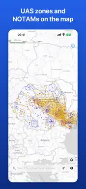
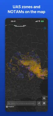
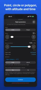
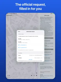
Drone Log takes you from "I want to fly here" to an authorized, logged flight — without opening five government websites. Not another drone map. A workflow. CHECK BEFORE YOU FLY Tap the map and set your operation: a point, a circle with a radius, or a polygon you draw yourself. Add maximum altitude, date and time. Drone Log analyses controlled airspace, restricted and prohibited areas, and active NOTAMs, then answers the only question that matters: can you fly here, and what does it take? You get a plain-language verdict with the reasons behind it — not a quote from a regulation. SEE THE REAL AIRSPACE UAS zones and NOTAMs from official sources, refreshed automatically, drawn as colour-coded layers you can switch on and off: restricted areas, aerodrome and CTR zones, active NOTAMs. KNOW WHO TO ASK For every zone your flight touches, Drone Log names the responsible authority and gives you its email address and phone number, ready to tap. The same for areas restricted by NOTAM, wherever the authority has said who grants approval. Three overlapping zones mean three approvals — you see all of them, with the steps and deadlines for each. LET THE APP WRITE THE REQUEST The official authorization form is generated for you, filled in from your pilot profile and the flight you just checked: coordinates, the outline of your operating area, time window, altitude limits, aircraft details. The same goes for the access request for military zones activated by NOTAM and the approval request for the NOTAM-restricted areas in northern Dobrogea. Send them by email with the form attached, or save them as a PDF to your phone. No more calculating coordinates by hand, hunting for the right authority, or writing the same request from scratch every time. KEEP THE RECORD Your fleet, the requests you have sent and the authority's answer to each, and your flight logbook. An approved request becomes a logbook entry on its own. BUILT FOR Recreational and professional pilots, aerial photographers, survey and inspection companies, agriculture operators, mapping teams and public services. You do not need an aviation background. Drone Log translates the rules into ordinary language and walks you through it step by step. GOOD TO KNOW Drone Log helps you plan and document your flights. The final decision and the responsibility for the flight remain yours, and the official sources of your civil aviation authority remain the reference.
What's New
Version 1.4.0 2026-11-04
What's new in 1.4.0 • KML zones: draw your flight area on the map, save it and download it as a KML file, ready to send to the authorities. • Your requests, st... Technical Analysis
Package Overview Basic metadata
Bundle ID
app.drone-log Current Version 1.4.0
Minimum iOS 17.0
Package Size App Store Size
Package Metadata 0 / 0 version records
Detailed binary, privacy manifest, framework, and Info.plist results have not been indexed for this package yet. The verified App Store and archive metadata above remains available.
Developer Information
Known Version Records
0 version records with stored package metadata
Stored metadata does not guarantee a package is currently available to download.
| Details | Version / IDs | Version date | Action |
|---|