Preview


Description
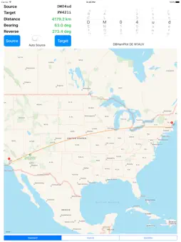
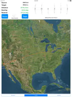
Compute distance and bearing using Maidenhead location. This was originally intended for use by amateur radio operators who participate in microwave communications however it can be used by any ham in order to determine a distance and bearing to another radio amateur. This version specifically for the iPad provides map and controls all on one screen. The larger map area over both iPhone versions should prove helpful. You get a map of the source and target along with a pin annotation and an overlay identifying the six-digit grid area. If a user touches an empty location on the screen for one second a new annotation is added at that spot identifying the grid. Any user-added annotations are removed if a new source or target are entered. This feature is great because you can zoom in on a location, touch the screen, and get a 6 digit grid; this is especially handy when your microwave buddy pulls over to the side of the road to make a contact with you (or someone else) but he/she has no idea what their grid square is.
What's New
Version 2.0 2017-07-24
Updated for latest iOS. Resolved issue with using location services. Added a Geodesic line between grids. I swapped the control and display on the top. I guess ... Technical Analysis
Package Overview Basic metadata
Bundle ID
com.SwineCat.DBHamPlot Current Version 2.0
Minimum iOS 9.1
Package Size Latest Recorded Package Size
Package Metadata 1 / 1 version records
5.0 / 5.0 (1 ratings)
Detailed binary, privacy manifest, framework, and Info.plist results have not been indexed for this package yet. The verified App Store and archive metadata above remains available.
Known Version Records
1 version record with stored package metadata
Stored metadata does not guarantee a package is currently available to download.
| Details | Version / IDs | Version date | Action |
|---|---|---|---|
 3.86 MB | v2.0 App Store ID: 841449747Build: 1 | 2021-04-15 20:56:50 | Get Version |