
Preview






Description
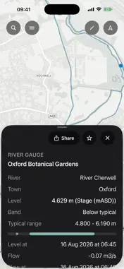
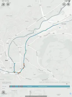
UK & European Rivers and canals, mapped for going somewhere. On the River is a detailed map and route planner for rivers and canals across Britain, Ireland, France, the Netherlands and Belgium. Browse named waterways, locks, clubs, photos and channel hints. Search for a river, canal, lock, club or gauge, then open it on the map. Plan a route along the water, switch to a footpath for a portage, or draw a straight section where the network has other ideas. See the distance, locks and published draft hints along the route. Save named routes on this device, share them or export GPX. Optional live layers show river gauges, Environment Agency flood boards and storm overflows in England. They are advisory, not a verdict on whether you should launch. The waterway map, route network, catalogues, locks, clubs and photo details are built into the app. Streets you have already viewed and walk sections you have already planned can remain available without a connection. New walk sections and live layers need the internet. No accounts. No login. Saved routes stay on this device. Planning only. Check local conditions, notices and access before travel. Gauge readings, published draft limits and suggested routes may be incomplete or wrong. You go on the water at your own risk.
Technical Analysis
Package Overview Basic metadata
Bundle ID
com.thingsthat.ontherivermap Current Version 1.0
Minimum iOS 17.0
Package Size App Store Size
Package Metadata 0 / 0 version records
Detailed binary, privacy manifest, framework, and Info.plist results have not been indexed for this package yet. The verified App Store and archive metadata above remains available.
Developer Information
Known Version Records
0 version records with stored package metadata
Stored metadata does not guarantee a package is currently available to download.
| Details | Version / IDs | Version date | Action |
|---|