
Preview






Description
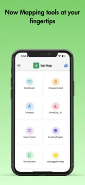
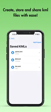
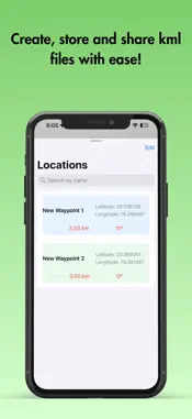
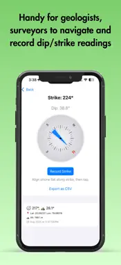
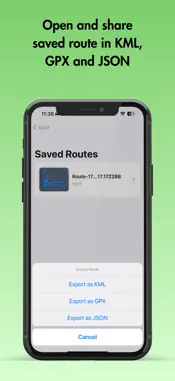
Explore. Record. Analyze. Share. — All in one place. We Map is an advanced field mapping and geospatial solution designed for explorers, geologists, surveyors, and anyone working with real-world map data. Key Features: - Waypoints & Polylines: Effortlessly create, edit, organize, and share both individual and collective waypoints and tracks. Drag and rearrange waypoint lists, search by name or coordinates, and view detailed info or quick zoom on each location. - Multiple Map Formats: Instantly switch between satellite, terrain, hybrid, and more to get the optimum map features for every project. - KML/KMZ Compatibility: Full support for file formats compatible with Google Earth and other professional mapping applications. Seamless import, export, edit, and sharing of your files in KML format. - Digital Compass & Geology Tools: Directly measure strike, dip, with geotag using your device—no physical compass and brunton needed. Export precise readings with location and altitude in CSV standard for further analysis or reporting. - Smart Route Recording: Log your journeys, visualize them as route streams, and share in popular formats for collaboration or backup. - Geotagged Photos with QR Codes: Instantly capture photos with timestamp, geolocation stamp, and an innovative QR code for exact map linking. Preview before saving, ensuring your image library stays relevant and organized. - Intuitive Interface: Simple navigation grid, quick dashboard access, and beautiful visualization for all tools—optimized for both field and office work. - Collaborative & Secure: Edit maps, share data, and provide feedback—all within a secure environment of your local storage while featuring Firebase authentication. - Complete Feedback Loop: Help us enhance We Map by sending direct feedback from within the app. Why Choose We Map? Empower your fieldwork with advanced mapping, geotagging, geological measurement, and instant sharing—making every exploration smarter, faster, and more collaborative. Ideal for: - Geologists, surveyors, field explorers - Researchers and educators - Outdoor adventurers and mapping enthusiasts Capture data, analyze routes, and share knowledge—We Map makes your field journey truly digital.
What's New
Version 1.10 2026-10-07
- New Settings option to show or hide polygon fills on KML maps - Clearer polygon and line display on the map - Duplicate shapes in KML files are now removed, g... Technical Analysis
Package Overview Basic metadata
Bundle ID
Swapnil.WayPoint Current Version 1.10
Minimum iOS 17.6
Package Size App Store Size
Package Metadata 1 / 10 version records
Detailed binary, privacy manifest, framework, and Info.plist results have not been indexed for this package yet. The verified App Store and archive metadata above remains available.
Developer Information
Known Version Records
1 version record with stored package metadata • 10 known version records
Stored metadata does not guarantee a package is currently available to download.
| Details | Version / IDs | Version date | Action |
|---|---|---|---|
| 54.36 MB | v1.9 App Store ID: 890123181Build: 1.9 | 2026-08-21 23:48:31 | Get Version |
| Not archived | App Store ID: 888756953 | Unknown | Request Version |
| Not archived | App Store ID: 884782404 | Unknown | Request Version |
| Not archived | App Store ID: 881898156 | Unknown | Request Version |
| Not archived | App Store ID: 881254026 | Unknown | Request Version |
| Not archived | App Store ID: 880775416 | Unknown | Request Version |
| Not archived | App Store ID: 879760521 | Unknown | Request Version |
| Not archived | App Store ID: 879537364 | Unknown | Request Version |
| Not archived | App Store ID: 879064794 | Unknown | Request Version |
| Not archived | App Store ID: 877649986 | Unknown | Request Version |