Preview


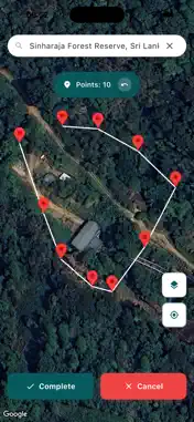

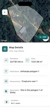
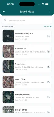
Description
CropLens is a precise, easy-to-use land measuring app built for field work. Whether you’re mapping a home plot, planning a farm, laying out an estate, or verifying a site plan, Croplens helps you measure area and distance in real time and save your work as reusable templates. WHY CROPLENS? • Fast, accurate, field-ready workflow with clear on-screen guidance • Real-time GPS tracking for walking the boundary or dropping points on the map • Save measurements as templates to reuse for recurring sites or standard plot shapes • Works online and offline; syncs when you’re back on a connection • Clean design that’s easy for anyone to learn in minutes WHAT YOU CAN DO • Measure area, perimeter and distance for plots, sub-plots and paths • Create polygons by walking the boundary (GPS/auto-trace) or tapping points • Snap, move and edit vertices to fine-tune shape and accuracy • Label plots, add photos, notes and custom attributes • Save as “Templates” so you can quickly reuse standard boundaries • Duplicate existing maps to capture seasonal or project-based versions • See live stats while measuring: remaining length, closed-shape alerts and more EXPORT & SHARE • Export CSV for spreadsheets and project records MADE FOR TEAMS • Secure sign-up/login with cloud backup so nothing is lost SMART CONTROLS • Choose units that match your workflow: m², ha, ac, perches, ft², km/mi • Multiple base maps: satellite, terrain, standard TYPICAL USES • Land surveying and site planning • Plantation/estate mapping with sub-plots • Agriculture layout, irrigation planning and fence lines • Construction site take-offs and material estimation • Real-estate listing maps and valuation support • Environmental audits and field research HOW IT WORKS 1) Create a new job and pick your base map. 2) Walk the boundary to auto-trace, or tap to place points. 3) Name the plot, add photos/notes and save as a reusable template. 4) Export a CSV—or share a link with your team. PRIVACY & SECURITY • Your maps are yours. Data is encrypted in transit and stored securely. • You control what is shared and with whom at every step. ACCURACY NOTE CropLens relies on your device’s GPS and mapping services. Accuracy can vary based on signal quality, environment and device hardware. For critical legal measurements, please consult a licensed surveyor. Get CropLens today and turn every field visit into reliable, ready-to-share measurements.
What's New
Version 3.0.2 2026-10-23
Bug fixes & performance improvements. Technical Analysis
Package Overview Basic metadata
Bundle ID
lk.avya.fieldmaster Current Version 3.0.2
Minimum iOS 15.0
Package Size App Store Size
Package Metadata 0 / 6 version records
Detailed binary, privacy manifest, framework, and Info.plist results have not been indexed for this package yet. The verified App Store and archive metadata above remains available.
Known Version Records
0 version records with stored package metadata • 6 known version records
Stored metadata does not guarantee a package is currently available to download.
| Details | Version / IDs | Version date | Action |
|---|---|---|---|
| Not archived | App Store ID: 885102352 | Unknown | Request Version |
| Not archived | App Store ID: 882566212 | Unknown | Request Version |
| Not archived | App Store ID: 882188032 | Unknown | Request Version |
| Not archived | App Store ID: 880505077 | Unknown | Request Version |
| Not archived | App Store ID: 880466661 | Unknown | Request Version |
| Not archived | App Store ID: 879930265 | Unknown | Request Version |