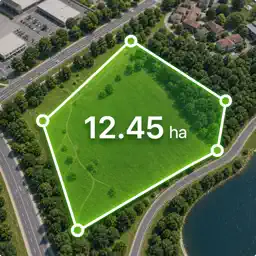
Preview

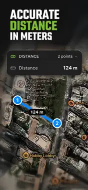
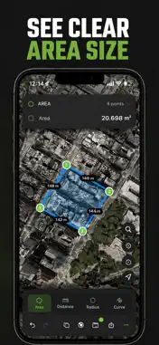

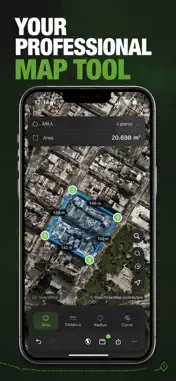


Description
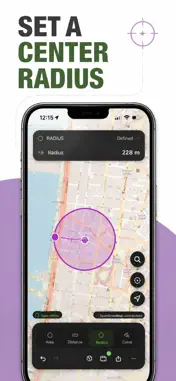
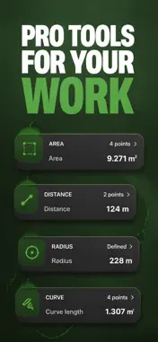
Measure any field, lot, plot, paddock or parcel from your device: walk the boundary, drop pins on the map, sweep a smooth curve through bends, or set a center and a radius. Get instant area, perimeter and distance with surveyor-grade output formats nobody else ships. WHO IT'S FOR Farmers, agronomists, land surveyors, real-estate agents and landowners, construction and landscape pros, foresters, golf-course and grounds teams, hikers, ramblers, bushwalkers and outdoor hobbyists. FOUR MEASUREMENT MODES • Area: tap polygon vertices on the map; three or more points enclose an area. Subtract inner holes for ponds, dams, roads, tracks or buildings. • Distance: drop pins along a path; the app sums every segment. • Radius: tap a center and an edge for an instant circle area and circumference. • Curve: anchor points and let the app run a smooth curve through them, so winding boundaries aren't forced into straight lines. FIVE MAP STYLES Standard, Satellite and Hybrid from Apple Maps, plus full OpenStreetMap and OpenTopoMap (topographic) overlays with built-in offline tile cache so the map stays usable when signal drops. PRO-GRADE EXPORTS (the real differentiator) • PDF report: print-ready, with map snapshot, totals, notes and photos • XLSX and CSV: drop straight into Excel or Numbers • KML and KMZ: Google Earth, ArcGIS, QGIS • GPX: for hikers, ramblers, bushwalkers and outdoor planners • DXF: open in AutoCAD, BricsCAD, LibreCAD • Shapefile (.shp / .zip): full GIS interoperability • Geo import: bring KML, KMZ, GPX, DXF or Shapefile back in as projects POWER FEATURES • AR Compass: live rear-camera view with a heading rose, altitude, position and a bearing-and-distance needle to any saved point. • Layers: stack a parcel, access road or track, and building footprint on the same project, each with its own color and visibility toggle. • Polygon operations: buffer (grow or shrink by N meters), holes (donut polygons that exclude inner regions), split (cut a parcel cleanly with a line). • Snapshots and project versions: never lose a measurement. • Coordinate display in Decimal, DMS, UTM or MGRS. • Photos attached to projects, with auto-resolved address for quick recognition in lists. • Address and place search to jump anywhere on the map. • Per-project unit and map preferences: re-opening a saved project shows the same numbers in the same units you originally captured. ALL THE UNITS YOU NEED Area in square meters, ares, hectares, square kilometers, square feet, square yards, acres or square miles. Distance in meters, kilometers, feet, yards, miles or nautical miles. Switch on the fly without losing the measurement. PROJECT ORGANIZATION • Folders for clients, regions or seasons • Save, edit, duplicate, version • Notes on every project • Quick share via Mail, Messages or Files PRIVACY-FIRST Your projects stay on device unless you explicitly export them. We don't track your location in the background. Permission prompts are explained in plain language. PREMIUM Pro subscription unlocks Curve mode, unlimited projects, PDF reports and pro export formats (DXF, Shapefile, XLSX, KML, GPX). Privacy Policy: https://suleapp.vercel.app/privacy Terms of Use: https://suleapp.vercel.app/terms
Technical Analysis
Package Overview Basic metadata
Bundle ID
com.field.measure Current Version 1.0
Minimum iOS 26.0
Package Size App Store Size
Package Metadata 0 / 1 version records
Detailed binary, privacy manifest, framework, and Info.plist results have not been indexed for this package yet. The verified App Store and archive metadata above remains available.
Developer Information
Known Version Records
0 version records with stored package metadata • 1 known version records
Stored metadata does not guarantee a package is currently available to download.
| Details | Version / IDs | Version date | Action |
|---|---|---|---|
| Not archived | App Store ID: 885211387 | Unknown | Request Version |