Preview


Description
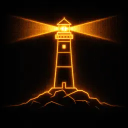
DatumLight — Lighthouses of Britain & Ireland A retro-styled nautical reference for every lighthouse around the coasts of Britain and Ireland. DatumLight renders its data through the warm phosphor glow of a CRT terminal, presenting lighthouse positions, characteristics, and flash patterns in authentic Admiralty chart style. CHART VIEW An interactive nautical chart plots every lighthouse as a six-pointed star marker, colour-coded by authority — Commissioners of Irish Lights, Trinity House, Northern Lighthouse Board, and Harbour Authorities. Pan and zoom across the full coastline from Muckle Flugga to the Lizard. Graticule grid lines, cartographic wave marks, and sea area labels complete the chart aesthetic. Tap any marker to see its callout with characteristic notation and flash animation. LIGHTS LIST Browse the complete database sorted and filtered by name, authority, county, or range. Each entry shows the lighthouse silhouette with its actual flash pattern playing in real time — phosphor decay and all. Tap through to the full detail view with position in DM/DMS format, sector diagram, range, and signal timing breakdown. IDENTIFY Count the flashes. Note the colour. Estimate the period. DatumLight's identification system lets you filter by characteristic type, light colour, flash count, and period to narrow down which light you're observing from shore or sea. Results show live flash animations matched to your filter criteria. CHART KEY A comprehensive legend explains every symbol, colour, abbreviation, and notation convention used throughout the app — from characteristic type codes (Fl, Oc, Iso, Q, LFl, Mo) to authority colour assignments and standard Admiralty notation examples. CONFIGURATION Switch between green and amber phosphor themes. Both colour palettes are designed for comfortable night viewing with authentic CRT warmth. FEATURES Complete lighthouse database for Ireland, England, Wales, Scotland, Channel Islands, and Isle of Man Live flash pattern animations with phosphor decay simulation Interactive chart with coastline, graticule, sea fill, and animated wave marks Authority colour-coding: CIL, Trinity House, NLB, Harbour Authority Light colour display: White, Red, Green sectors Full characteristic decoding with signal timing diagrams Sector diagrams showing light coverage arcs Position display in Degrees/Minutes and Degrees/Minutes/Seconds CRT scanline overlay and phosphor glow effects throughout Green and Amber display themes No internet connection required — all data is bundled Built for mariners, lighthouse enthusiasts, and anyone who appreciates the beauty of navigational aids rendered through the aesthetic of a bygone terminal era.
Technical Analysis
Package Overview Basic metadata
Bundle ID
com.fiddlemeragged.DatumLight Current Version 1.0
Minimum iOS 26.2
Package Size App Store Size
Package Metadata 0 / 1 version records
Detailed binary, privacy-manifest, framework, and Info.plist results have not been indexed for this package yet. The verified App Store and archive metadata above remains available.
Developer Information
Known Version Records
0 version records with stored package metadata • 1 known version records
Stored metadata does not guarantee a package is currently available to download.
| Details | Version / IDs | Version date | Action |
|---|---|---|---|
| Not archived | App Store ID: 883311478 | Unknown | Paid / Arcade |