
Preview




Description
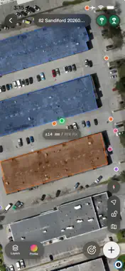
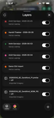
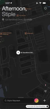
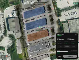
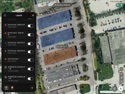
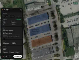
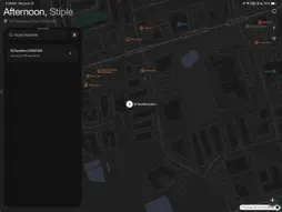
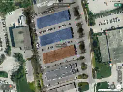
Mapdesk turns your iPhone or iPad into a field surveying controller. Connect an RTK rover over Bluetooth, stream NTRIP corrections, and capture survey points with live accuracy feedback — no laptop, no clipboard. CAPTURE • Point capture with live RTK status and accuracy readout • Averaging profiles — Quick, Standard, and Precise occupations • Live motion indicator shows when you're stable enough to log • Full point metadata: rover, antenna height, base, and timestamp STAKE OUT • Pick any point and navigate back to it in the field • Precision loupe for selecting points on dense maps ORGANIZE • Projects on a map — find your sites at a glance • Layers with per-layer colors and marker shapes • Geometry-aware feature info for points, lines, and polygons HARDWARE • Bluetooth rover connection with antenna height management • Tap-to-connect with NFC tags (iPhone) • Base station setup with mountpoint selection and known-point calibration Captures sync to your Stiple workspace, so field data lands where the rest of your team works.
What's New
Version 1.4 2026-10-07
Mapdesk 1.4 brings Stiple Caster into the app, adds stake-out to a surface, and walks you through setting up tilt. Stiple Caster • Pick a base from a list of y...Mapdesk 1.4 brings Stiple Caster into the app, adds stake-out to a surface, and walks you through setting up tilt. Stiple Caster • Pick a base from a list of your bases, nearest first, instead of typing its code. You can still enter a base code • Relays are listed above your bases and connect the same way • Manage your Caster devices in the app: relays, bases, rovers and drones • See a device's host, port, mount point, username and password, and copy each one • Give a device a friendly name, replace its password, turn it on or off, or make a new one • Add a relay and its source from the app, see whether the source is answering, and edit it • Set a receiver up for Stiple Caster in one tap from Configure, as a base or as a rover • Mapdesk now connects to Stiple Caster at corrections.live Stake-out • Stake out to a LandXML surface, with live cut and fill • Choose Point or Surface from one stake-out sheet • Set an offset and a tolerance for surface stake-out • LandXML files in your project show on the map as layers Capture and tilt • Choose how long a point is held: 1, 5, 15, 30 or 60 seconds • Turn on tilt from the rover screen, with a drawing of what to measure on the pole • Rock the pole to calibrate, and Mapdesk tells you when tilt is ready • A warning shows if tilt is lost during a job • Pole height is entered once and sent to the receiver Receiver • Factory reset a receiver from Configure • More settings in Configure: PPP, LoRa, network and Bluetooth options • Diagnostics shows satellites by constellation, and the north and east errors behind H Accuracy • New drawings for the receiver, the pole and empty screens Projects and people • New Project has a coordinate system step, and a project's coordinate system can be changed later • The People tab lists every project member with their role • Invite people by email or with a link, and manage roles Fixes • During point averaging, a reading's position and status now land together • Tilt settings show again on receivers running firmware 3.4 • Scanned PDFs no longer open as a blank page when georeferencing Requires iOS 18 or later. Technical Analysis
Package Overview Basic metadata
Bundle ID
ca.stiple.mapdeskapp Current Version 1.4
Minimum iOS 18.0
Package Size App Store Size
Package Metadata 0 / 1 version records
Detailed binary, privacy manifest, framework, and Info.plist results have not been indexed for this package yet. The verified App Store and archive metadata above remains available.
Developer Information
Known Version Records
0 version records with stored package metadata • 1 known version records
Stored metadata does not guarantee a package is currently available to download.
| Details | Version / IDs | Version date | Action |
|---|---|---|---|
| Not archived | App Store ID: 885878080 | Unknown | Request Version |