
Preview



Description
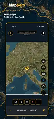
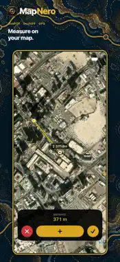
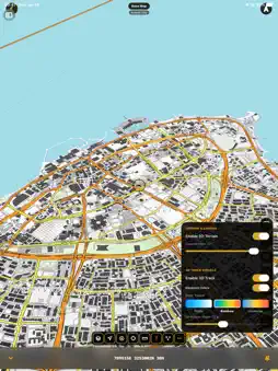
Your maps belong in the field. MapNero brings your own maps, GPS tracks and field observations together on iPhone and iPad—even beyond network coverage. Use it for a site survey, a forest inspection, a trail walk, a bike ride or a mine-action mapping workflow. YOUR MAPS, OFFLINE Import GeoPDF and GeoTIFF maps with no map-count limit, including in Free. Follow your GPS position on the maps you already use and keep essential field information close at hand. Prepare your maps before heading into the field. Online searches, downloads and team synchronization require a connection. A WORKSPACE THAT FITS YOUR TASK Choose a mode to preset tools, symbols, units and coordinate formats. Change modes in Settings or create a Custom setup. • Surveyor / GIS: a focused workspace for coordinates, measurements and field mapping. • Forestry: a setup for forest and land-management fieldwork. • Hiker: maps, waypoints and tracks for time on the trail. • Cyclist: routes, position and track recording for your rides. • EOD / Mine Action: specialized mapping tools and professional symbology for operational documentation. • General / Custom: start simple or arrange the workspace around your own workflow. RECORD WHAT YOU FIND Create georeferenced points, lines and polygons. Record GPS tracks, measure distances and areas, and use structured field templates to keep observations consistent. BRING YOUR GIS DATA Work with KML, KMZ and GPX alongside professional formats including GeoJSON, Shapefile and GeoPackage. Move field information between MapNero and your desktop GIS workflow. COORDINATES FOR FIELDWORK Use UTM, MGRS and other coordinate formats. External GNSS support is available in Beta for Pro and Team. Compatibility depends on your receiver, device and connection method. START WITH YOUR OWN MAPS Download MapNero free and import your GeoPDF and GeoTIFF maps. Advanced tools and team features are available through paid plans; availability depends on your plan. 20 LANGUAGES English, Turkish, German, French, Italian, Spanish, Arabic, Urdu, Hindi, Ukrainian, Russian, Portuguese, Japanese, Greek, Indonesian, Malay, Afrikaans, Polish, Simplified Chinese and Korean. One map. Many ways.
What's New
Version 2.2.5 2026-11-01
• Point CSV exports keep notes and custom fields separate when reimported. • GPX files retain point, route and track notes. • Pro/Team: export saved field recor... Technical Analysis
Package Overview Basic metadata
Bundle ID
com.mapnero.MapNeroApp Current Version 2.2.5
Minimum iOS 17.0
Package Size App Store Size
Package Metadata 0 / 0 version records
Detailed binary, privacy manifest, framework, and Info.plist results have not been indexed for this package yet. The verified App Store and archive metadata above remains available.
Developer Information
Known Version Records
0 version records with stored package metadata
Stored metadata does not guarantee a package is currently available to download.
| Details | Version / IDs | Version date | Action |
|---|