Preview







Description
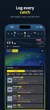
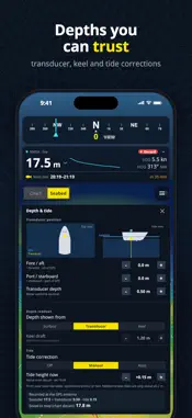
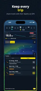
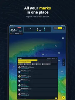
Turn the fishfinder you already own into a 3D map of the seabed. NMEA Mapper 3D reads depth and GPS from your boat over Wi-Fi and builds a detailed 3D chart of the bottom as you drive: every ledge, drop-off, reef and pinnacle you pass over, saved privately on your phone. No new hardware. No subscription. MAP THE SEABED IN 3D • Press Record and watch the bottom take shape behind your boat, sounding by sounding • Tilt, turn and zoom over reefs, wrecks, channels and drop-offs • Depth colours or a textured seabed, with contour lines from 1 to 100 m, ft or fathoms • See on the chart exactly where you have mapped, and dive into 3D anywhere you have been LIVE DEPTH SONAR • A fishfinder-style depth history over 1, 2 or 10 minutes • Scroll back, tap any moment to see the depth and exactly where it was, then mark it • The bottom ahead along your course, drawn from your own map • Shallow-water alarm, minimum and maximum depth, water temperature CHARTS & SEAMARKS • Street chart or satellite view, with buoys, lights and harbour marks from OpenSeaMap • Areas you have viewed are kept for use offline • Follow your boat north-up or heading-up, and rotate the map with two fingers MARK YOUR SPOTS • Fish, schools, reefs, wrecks, hazards, anchorages and pins, with species, colour, notes and depth • Distance and depth to every mark at a glance • Import and export your marks as GPX EVERY TRIP SAVED • Each recording becomes a track with its depths, distance and time • Share any track with its depths as GPX CATCH LOG • Species, length, weight, bait and a photo in seconds • Depth, water temperature, moon phase and bite period are filled in for you • Insights show what your best days have in common BITE TIMES • Solunar calendar with major and minor bite periods for your spot • Sunrise, sunset, moonrise, moonset and moon phase • Reminders before the next bite period DEPTHS YOU CAN TRUST • Set your transducer depth and keel offset, and show depth below the surface, transducer or keel • Tide correction: automatic from nearby tide stations where available, or set by hand WORKS WITH YOUR BOAT NMEA Mapper 3D connects to any NMEA 0183 source over Wi-Fi (TCP or UDP): a Wi-Fi gateway or multiplexer, or a chartplotter or fishfinder with Wi-Fi NMEA output. NMEA 2000 networks work through a gateway that sends NMEA 0183 over Wi-Fi. The app finds your source automatically and reads depth (DBT, DPT), position, speed and course (RMC, GGA, GLL, VTG), heading (HDT, HDG, HDM) and water temperature (MTW). For accuracy, depths are recorded only with GPS from your boat's NMEA feed. Without it, your phone's GPS still shows where you are on the map. YOUR DATA STAYS YOURS No account and no uploading. Your maps, marks, tracks and catches stay on your device. FREE TO USE Every feature is free, supported by ads. Remove the ads for good with a one-time purchase. No subscription. Day, dusk and night display modes. Metres, feet or fathoms. iPhone and iPad. Important: NMEA Mapper 3D is a fishing and mapping aid. It is not a certified navigation system and does not replace official nautical charts, a chartplotter or good seamanship.
Technical Analysis
Package Overview Basic metadata
Bundle ID
com.etnapps.nmeamapper3d Current Version 1.0
Minimum iOS 15.0
Package Size App Store Size
Package Metadata 0 / 0 version records
Detailed binary, privacy manifest, framework, and Info.plist results have not been indexed for this package yet. The verified App Store and archive metadata above remains available.
Developer Information
Known Version Records
0 version records with stored package metadata
Stored metadata does not guarantee a package is currently available to download.
| Details | Version / IDs | Version date | Action |
|---|