
Preview








Description
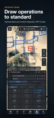
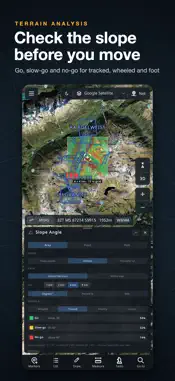
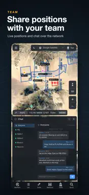
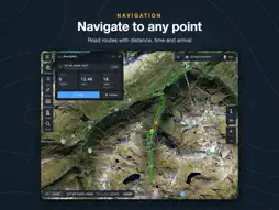
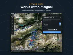
Achilleus 3D Tactical Map turns your iPhone and iPad into a complete field mapping system: real 3D terrain, every common grid, drone control, patrols and video, an AR view, offline maps and a team network encrypted end to end, with no external server needed. Built for soldiers and reservists, security teams, first responders, search and rescue, drone pilots and outdoor professionals. DRONE CONTROL (GROUND STATION) • Fly ArduPilot and PX4 multirotors from your map over Wi-Fi or a network: take off, Pause, Return, Land, Fly here, Orbit, Point the camera • Missions with heights above the ground: waypoints, surveys, corridors, orbits and search patterns, checked for terrain, radio range and battery • Listen-only by default, every move confirmed with a slide, MAVLink 2 signing, geofence • Practice drones to train; QGroundControl and Mission Planner files; flight logs DRONE PATROL • Guard a site with several drones: draw the area or pick one of your shapes; along the edge, the whole area or watch points, each drone on its own part • Alerts for people and vehicles with a snapshot, time and coordinates; the nearest drone goes to look • Battery changes planned: a drone low on battery is relieved and its part covered • Detections list with Go to and CSV; alerts to your team and TAK only if you choose FLY WITHOUT GPS (DIGITAL INS) • GPS jammed? The app keeps flying your ArduPilot or PX4 drone on an inertial estimate learned from how it leans and flies, with an honest circle of where it is • Catches a spoofed GPS that jumps or lies, and tells the drone to drop it • Fix it by tapping a landmark, or let map match find the camera's view on the satellite map • Link lost too: a helper on the drone flies it home (ArduPilot). After landing, its own log gives the exact track LIVE VIDEO FROM DRONES & CAMERAS • Drones, ground stations and IP cameras beside the map (RTSP, UDP, HLS), placed from STANAG 4609 (KLV) or MAVLink with the camera's footprint • Tap the video to mark that spot; detect and follow people and vehicles; your markers in the drone's picture • ONVIF pan, tilt and zoom; recording with map data and replay AR VIEW (AUGMENTED REALITY) • Hold up your phone: markers, teammates, TAK users, drones and drawings in their real places in the camera picture, with distance and height • North fine-tuned offline on a landmark or the skyline; 2× zoom; mark a point under the cross 3D TERRAIN & OFFLINE MAPS • Real terrain in 3D; satellite, topographic and street maps, or your own XYZ, WMTS and WMS sources • Download areas and keep working without signal; red night mode COORDINATES & GRIDS • MGRS, UTM, Lat/Lon, British and Indian grids, in WGS 84, ED50 and other datums • Convert one point or a whole list; Go to any position MEASURE & ANALYSE • Distance and bearing in mils or degrees; elevation profiles and slope • Line of sight and viewshed; the highest and lowest points of an area; KMZ export MARKERS, DRAWINGS & TACTICAL GRAPHICS • MIL-STD-2525D symbols, flags or your own icons, with photos, range rings and layers • Lines, routes and areas; operation plans with task graphics; KML, KMZ and GPX NAVIGATE & RECORD • Walk or drive to any point; record GPS tracks and share your location ENCRYPTED TEAM NETWORK & TAK • Wi-Fi, LAN or internet, through a server any device runs or in Mesh mode with no server; encrypted end to end (AES-256) with a team password • Chat, voice messages and spoken team orders • ATAK, WinTAK and iTAK users on your map and you on theirs, GeoChat MADE FOR THE FIELD • Portrait and landscape on iPhone and iPad, adjustable interface size • No account needed: your data stays on your device Achilleus is a planning and navigation aid. Always confirm critical positions with official maps and procedures, and follow your local drone rules. Questions or ideas? Use Settings › Contact — we read every message.
What's New
Version 4.1 2026-11-16
Achilleus 4.1 brings drone patrols, flying without GPS (a digital INS against jamming and spoofing), voice messages in the team chat, the AR view, Mesh mode and...Achilleus 4.1 brings drone patrols, flying without GPS (a digital INS against jamming and spoofing), voice messages in the team chat, the AR view, Mesh mode and TAK. NEW: DRONE PATROL (Drone control › Patrols, or a shape's Patrol button) • Set a patrol up in six steps: the area (drawn or one of your shapes), along the edge, the whole area or watch points such as gates, the drones, the alerts and the checks • Each drone flies its own part, its mission repeating until you end it. The map shades each part by how long ago a drone saw it • Alerts for people or vehicles found by Detect on each drone's video: a snapshot, the time, where and how many, with a sound. The nearest drone with battery to spare goes to look, then back to its part • Battery: a drone low on battery flies home and the standby takes over (it asks first, or automatic); the others cover its part meanwhile • Detections: every alert with its pictures, Go to, False alarm and CSV export. Alerts go to your team and TAK only if you switch it on • Practice drones with pretend people and cars, to try a patrol first NEW: FLY WITHOUT GPS, A DIGITAL INS (a drone's page › Fly without GPS) • For ArduPilot and PX4 multirotors under GPS jamming or spoofing. A short learning flight teaches the app how your drone leans and flies, and it learns more on every flight with GPS • GPS jammed: the app flies the drone on its own estimate at once (Guided without GPS on ArduPilot, Offboard on PX4), on to where it was going. The map shows it hollow, inside a circle it is in 19 times in 20 • GPS spoofed: a position that jumps, races or disagrees with the drone's lean is caught and ignored, and the drone is told to drop its GPS. GPS is used again only when it agrees • Course and speed, Return and Land without GPS. Fix it by tapping a landmark on the map or the video, or let map match fix it by itself from a down-looking camera • Link lost too: a small helper the app puts on ArduPilot drones flies it home, and its record comes back with the link • After landing: a report, the exact track from the drone's own flight log, and the jamming areas on the map (shared only if you choose) NEW: VOICE MESSAGES (Net › Chat) • With the message field empty, Send becomes a microphone: tap, speak (up to a minute), tap again to send, to everyone or to one teammate • Encrypted like the chat. • Tap ▶ to listen; nothing plays in Silent mode. Or let them play as they arrive, like a radio (Settings › Sound & vibration) NEW: AR VIEW (GPS status › AR view) • Hold up your phone or tablet: markers, teammates, TAK users, drones and drawings in their real places in the camera picture, with distance and height. Labels never overlap; what a ridge hides is dimmed • Fine-tune north offline, mark a point under the cross, Go there, 2× zoom, photos with the labels • AR on drone video: your markers, team and drawings placed in the drone's picture NEW: MESH MODE, TAK AND TEAM ORDERS • Mesh mode: a team network with no server at all, encrypted with the team password • TAK: ATAK, WinTAK and iTAK users on your map and you on theirs, GeoChat and an emergency alert • Spoken team orders with the replies as a tally; new sounds, Silent mode and vibration • The network reconnects by itself. Hosting over the internet is now a switch, off by default (Net › Connection): if you hosted over the internet before, turn it on IMPROVED • Maps sharpen much faster after you zoom or move. • Fixed: after long use, the map could run out of memory and the app close while scrolling • The map stays sharp after a big jump in zoom; Convert a list fits a landscape screen; fire mission reports show for every target Thank you for your feedback. Ideas or problems? Settings › Contact. Technical Analysis
Package Overview Basic metadata
Bundle ID
com.sawag3.Gun-Commander Current Version 4.1
Minimum iOS 15.0
Package Size App Store Size
Package Metadata 0 / 23 version records
Detailed binary, privacy manifest, framework, and Info.plist results have not been indexed for this package yet. The verified App Store and archive metadata above remains available.
Price History (USA store)
2 recorded price change points. These are historical observations, not a guarantee of the current price.
| Recorded at | Price | Currency |
|---|---|---|
| 14.99 | USD | |
| 19.99 | USD |
Developer Information
Known Version Records
0 version records with stored package metadata • 23 known version records
Stored metadata does not guarantee a package is currently available to download.
| Details | Version / IDs | Version date | Action |
|---|---|---|---|
| Not archived | App Store ID: 882258040 | Unknown | Paid / Arcade |
| Not archived | App Store ID: 876932962 | Unknown | Paid / Arcade |
| Not archived | App Store ID: 871036912 | Unknown | Paid / Arcade |
| Not archived | App Store ID: 870986589 | Unknown | Paid / Arcade |
| Not archived | App Store ID: 868133662 | Unknown | Paid / Arcade |
| Not archived | App Store ID: 861596884 | Unknown | Paid / Arcade |
| Not archived | App Store ID: 861397775 | Unknown | Paid / Arcade |
| Not archived | App Store ID: 861277722 | Unknown | Paid / Arcade |
| Not archived | App Store ID: 860462347 | Unknown | Paid / Arcade |
| Not archived | App Store ID: 857577144 | Unknown | Paid / Arcade |
| Not archived | App Store ID: 853619650 | Unknown | Paid / Arcade |
| Not archived | App Store ID: 852585490 | Unknown | Paid / Arcade |
| Not archived | App Store ID: 839860676 | Unknown | Paid / Arcade |
| Not archived | App Store ID: 839120753 | Unknown | Paid / Arcade |
| Not archived | App Store ID: 838409859 | Unknown | Paid / Arcade |
| Not archived | App Store ID: 837946265 | Unknown | Paid / Arcade |
| Not archived | App Store ID: 837740154 | Unknown | Paid / Arcade |
| Not archived | App Store ID: 837590042 | Unknown | Paid / Arcade |
| Not archived | App Store ID: 837494655 | Unknown | Paid / Arcade |
| Not archived | App Store ID: 837189633 | Unknown | Paid / Arcade |
| Not archived | App Store ID: 836717356 | Unknown | Paid / Arcade |
| Not archived | App Store ID: 835993184 | Unknown | Paid / Arcade |
| Not archived | App Store ID: 810965036 | Unknown | Paid / Arcade |