Preview




Description
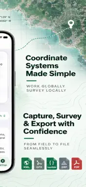
Topo Map - Georeferencing is a powerful, all-in-one mobile solution designed to streamline field surveying, spatial measurement, and land management on iPhone and iPad (Paid Subscription Required). Built for surveyors, civil engineers, GIS professionals, real estate assessors, and field technicians, Topo Map eliminates the need for heavy equipment in preliminary assessments by turning your mobile device into a versatile geospatial workstation. Boost your productivity in the field with fast GNSS data collection, real-time perimeter calculations, route tracking, and instant CAD/GIS export capabilities. IMPORTANT SUBSCRIPTION NOTICE: Topo Map requires an active paid subscription to access all features and tools described below. Subscription options, pricing, and billing terms are clearly displayed inside the app prior to purchase. PAID SUBSCRIPTION FEATURES FIELD PROJECTS (Subscription Required) Organize field notebooks and projects with status information, location descriptions, summaries, and thumbnails. Save recorded perimeter polygons and review Map and Survey previews. GPS & GEOREFERENCING (Subscription Required) Use your device’s GPS to collect positions, record GNSS-based points, associate locations with projects, and review collected data directly on the map. SURVEY & ANALYSIS (Subscription Required) Estimate footprint and area from recorded corners, review slope information based on GNSS elevations, and use planning-oriented cut/fill-style volume estimates. (Note: These calculations are intended for preliminary field analysis and are not a substitute for a verified DTM, professional survey, or certified engineering workflow.) MAP (Subscription Required) Use road or hybrid satellite views, supported terrain views, compass and scale information, recorded route overlays, draft polygons, markers, and your current location when permission is granted. PERIMETER WALK (Subscription Required) Record approximate parcel or property outlines while walking or driving. Capture GPS positions at important corners, complete a perimeter with at least three vertices, and calculate approximate perimeter and area. ROUTE RECORDING (Subscription Required) Record routes using your device’s location services and review saved paths on the map. IMPORT & EXPORT (Subscription Required) Save and organize collected information and export supported geospatial data for use with spreadsheets, GIS software, CAD applications, mapping tools, and other compatible workflows. All georeferencing, mapping, survey, perimeter recording, route tracking, analysis, import, export, and project-management features require a separate paid subscription. TERMS OF USE (EULA): https://www.apple.com/legal/internet-services/itunes/dev/stdeula/
What's New
Version 9.0 2026-09-27
Bug Fixes Technical Analysis
Package Overview Basic metadata
Bundle ID
Colombo.Topo-Map---Georeferencing Current Version 9.0
Minimum iOS 17.6
Package Size App Store Size
Package Metadata 0 / 4 version records
Detailed binary, privacy manifest, framework, and Info.plist results have not been indexed for this package yet. The verified App Store and archive metadata above remains available.
Price History (USA store)
5 recorded price change points. These are historical observations, not a guarantee of the current price.
| Recorded at | Price | Currency |
|---|---|---|
| 7.99 | USD | |
| 12.99 | USD | |
| 7.99 | USD | |
| 6.99 | USD | |
| 0.0 | USD |
Known Version Records
0 version records with stored package metadata • 4 known version records
Stored metadata does not guarantee a package is currently available to download.
| Details | Version / IDs | Version date | Action |
|---|---|---|---|
| Not archived | App Store ID: 887262193 | Unknown | Request Version |
| Not archived | App Store ID: 886857176 | Unknown | Request Version |
| Not archived | App Store ID: 886749957 | Unknown | Request Version |
| Not archived | App Store ID: 885992015 | Unknown | Request Version |