Preview
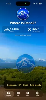

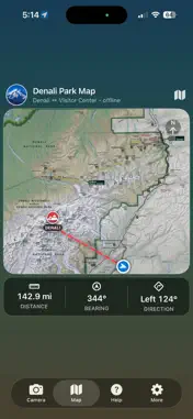


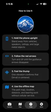
Description
Find Denali--even when you can't see it. Every year, thousands of visitors come to Denali National Park hoping to see North America's highest peak. Unfortunately, clouds often hide it completely. Where's Denali? uses your iPhone's GPS, compass, and motion sensors to show exactly where Denali is located. Simply point your phone at the landscape and the mountain appears in its proper position on the live camera view. Features +Live camera overlay +Works without cellular service +Offline park map +Distance and compass bearing +Visual guidance arrows +Haptic confirmation when centered +Accurate mountain positioning +No ads +No account required +Privacy friendly Perfect for: +Park visitors +Road travelers +Hikers +Photographers +Tour Guides Designed Specifically for Denali National Park --by Alaskans The app was built to help visitors answer the most common question in the park: "Where is Denali?"
Technical Analysis
Package Overview Basic metadata
Bundle ID
com.robertwerner.WheresDenali Current Version 1.0.1
Minimum iOS 17.0
Package Size App Store Size
Package Metadata 0 / 0 version records
Detailed binary, privacy manifest, framework, and Info.plist results have not been indexed for this package yet. The verified App Store and archive metadata above remains available.
Known Version Records
0 version records with stored package metadata
Stored metadata does not guarantee a package is currently available to download.
| Details | Version / IDs | Version date | Action |
|---|