
Preview


Description
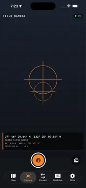
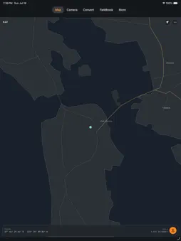
Datumark turns your iPhone into a precise field-survey instrument. Capture coordinate-stamped photos, measure distances and areas on site, convert between coordinate systems, and export clean data files — entirely on device. No account. No cloud. No tracking. Your position data never leaves your phone. Built for surveyors, construction and utility crews, field researchers, inspectors, geocachers and anyone who needs trustworthy position data where there is no signal. GPS FIELD CAMERA • Burn coordinates, bearing, altitude, datum and magnetic declination directly into each photo • Choose the coordinate readout: latitude/longitude, UTM or MGRS • Writes standard EXIF GPS geotags into every image • On a device without a usable camera it still records a clean coordinate field card, so nothing is lost COORDINATE CONVERTER • Convert any position across latitude/longitude, UTM and MGRS • Switch geodetic datums — WGS 84, NAD 83, NAD 27, ED50, OSGB 1936, Tokyo, Pulkovo 1942 — with full 7-parameter Helmert transforms • Degrees / minutes / seconds, degrees-minutes, or decimal degrees • Grid convergence and point-scale factor for every location • Enter coordinates by hand or read your live GPS fix ON-SITE MEASUREMENT • Distance along a path and enclosed area, computed on the reference ellipsoid (Vincenty geodesics) • Metric or imperial: metres, kilometres, feet, miles, hectares, acres • Log waypoints and record tracks in the field MAGNETIC DECLINATION & ELEVATION • Full World Magnetic Model (WMM2025) computed on device — declination, inclination and field strength for any point and date • EGM96 geoid model converts GPS ellipsoidal height to orthometric (mean-sea-level) elevation OFFLINE VECTOR BASEMAP • A worldwide vector basemap — coastlines, country and state borders, rivers, lakes, roads and thousands of populated places — renders directly on device • Pan and zoom smoothly with no tiles to download and nothing fetched from a server CLEAN EXPORTS • Export waypoints, tracks and measurements as GPX, KML, GeoJSON or CSV • Share anywhere with the standard share sheet — files are generated on your device BUNDLED REFERENCE DATA (all included, all offline) • World Magnetic Model 2025 coefficients (NOAA / NGA / BGS, public domain) • EGM96 geoid-undulation grid (public domain) • Datum transformation parameters • A worldwide Natural Earth vector basemap (public domain) PRIVATE BY DESIGN Datumark works in airplane mode, in a dead-zone canyon, offshore, or underground. Everything is computed on your device from bundled reference data. There is no login, no tracking, and no server — your locations, photos and field notes stay with you. Take it into the field.
Technical Analysis
Package Overview Basic metadata
Bundle ID
com.realbobcorbin.Datumark Current Version 1.0
Minimum iOS 17.0
Package Size App Store Size
Package Metadata 0 / 0 version records
Detailed binary, privacy manifest, framework, and Info.plist results have not been indexed for this package yet. The verified App Store and archive metadata above remains available.
Price History (USA store)
3 recorded price change points. These are historical observations, not a guarantee of the current price.
| Recorded at | Price | Currency |
|---|---|---|
| 3.99 | USD | |
| 0.0 | USD | |
| 3.99 | USD |
Developer Information
Known Version Records
0 version records with stored package metadata
Stored metadata does not guarantee a package is currently available to download.
| Details | Version / IDs | Version date | Action |
|---|