
Preview




Description
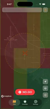
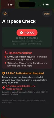
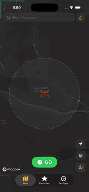
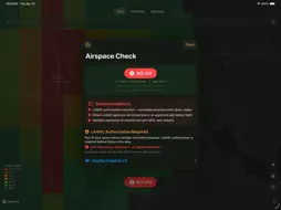
Every drone pilot knows the moment: you arrive at a location, props ready, and wonder - can I actually fly here? Dronelytics Preflight answers that question instantly. Tap anywhere on the map and get a clear GO, CAUTION, or NO-GO status backed by live FAA airspace data. No guesswork. No regulatory confusion. Just a straight answer before you launch. WHAT YOU GET Instant airspace status - GO, CAUTION, or NO-GO for any location in the US LAANC grid overlay - see ceiling limits by zone, color-coded from 0 ft (no fly) to 400 ft Controlled airspace alerts - Class B, C, D, and E boundaries with authorization requirements TFR monitoring - active and nearby Temporary Flight Restrictions NOTAM alerts - relevant notices affecting your flight area Airport proximity warnings - nearby airports with distance and bearing Mode C veil detection - know when you're inside transponder-required airspace Stadium and special use airspace alerts FRIA site locations for recreational flyers Military training route awareness National security restriction zones BUILT FOR DRONE PILOTS This is not a general aviation app adapted for drones. Preflight was built from the ground up for Part 107 and recreational UAS pilots. Every feature answers one question: is it safe and legal to fly here? The airspace briefing breaks down exactly what restrictions apply, why they matter, and what authorization you need. No aviation jargon without context. SAVE YOUR SPOTS Found a great location? Save it as a favorite with coordinates and last-known airspace status. Check conditions again before your next visit with one tap. MAP FEATURES Mapbox-powered dark, light, and satellite views Adjustable query radius (1-50 nm) Aviation and metric unit systems LAANC ceiling legend overlay Search any location by name DATA YOU CAN TRUST Preflight queries live FAA airspace data including LAANC grids, TFRs, NOTAMs, controlled airspace boundaries, and special use areas. Every briefing shows the exact query time and coordinates. Important: Dronelytics Preflight is an informational tool. Always verify with official FAA sources before flight.
What's New
Version 1.0.1 2026-04-29
MapBox fix Technical Analysis
Package Overview Basic metadata
Bundle ID
io.dronelytics.preflight Current Version 1.0.1
Minimum iOS 18.0
Package Size App Store Size
Package Metadata 1 / 2 version records
Detailed binary, privacy manifest, framework, and Info.plist results have not been indexed for this package yet. The verified App Store and archive metadata above remains available.
Developer Information
Known Version Records
1 version record with stored package metadata • 2 known version records
Stored metadata does not guarantee a package is currently available to download.
| Details | Version / IDs | Version date | Action |
|---|---|---|---|
| 29.34 MB | v1.0.1 App Store ID: 885040068Build: 1.0.1 | 2026-04-29 04:02:18 | Get Version |
| Not archived | App Store ID: 884876215 | Unknown | Request Version |