
Preview





Description
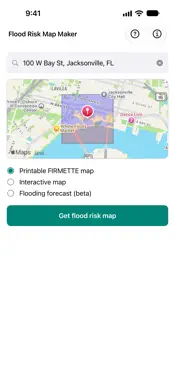
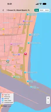
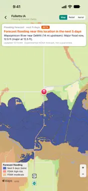
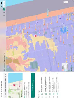
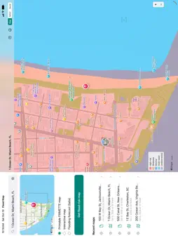
Flood Risk Map Maker displays a map that shows the flood-prone areas near a given street address in the United States. Identify flood zones to watch out for after a rainstorm, tropical storm, or hurricane. To use: - Type your street address - Tap "Get Flood Risk Map" Depending on the availability of the flood study data in your area, this app will generate one of the following results: - Areas with modern digital FEMA flood study data: A printable PDF showing about 400 acres or about 0.6 sq. mi. - Areas with old FEMA flood study data: A scanned image of an older printed map - Remote areas where a FEMA flood study has not been conducted: No map available - Interactive map (beta): Pan and zoom a live map with color-coded flood zone overlays Ideal for: - Homeowners and home buyers - Real estate agents - Farmers - Insurance professionals - Businesspeople - Anyone doing a risk assessment or asking "Am I in a flood zone?" Ad-supported. If you like the app, please consider upgrading to remove the ads and support future development.
What's New
Version 1.1.8 2026-10-21
Behind-the-scenes changes to keep things running smoothly. Technical Analysis
Package Overview Basic metadata
Bundle ID
com.qvyshift.flood Current Version 1.1.8
Minimum iOS 16.0
Package Size App Store Size
Package Metadata 0 / 3 version records
Detailed binary, privacy manifest, framework, and Info.plist results have not been indexed for this package yet. The verified App Store and archive metadata above remains available.
Developer Information
Known Version Records
0 version records with stored package metadata • 3 known version records
Stored metadata does not guarantee a package is currently available to download.
| Details | Version / IDs | Version date | Action |
|---|---|---|---|
| Not archived | App Store ID: 887751440 | Unknown | Request Version |
| Not archived | App Store ID: 886155077 | Unknown | Request Version |
| Not archived | App Store ID: 884605271 | Unknown | Request Version |