Preview



Description
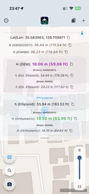
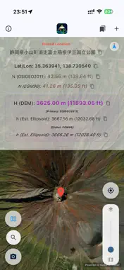
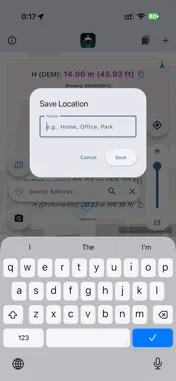
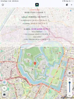
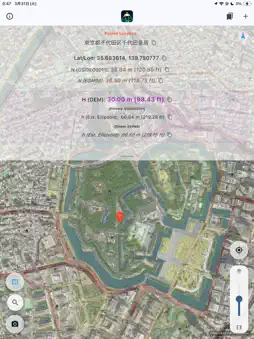
Geoid Altimeter is an elevation tracking tool built for field professionals. It applies high-precision geoid models to your smartphone's GPS ellipsoidal height to display a practical "orthometric height" (elevation above mean sea level). Try all features completely free for the first 30 days. Experience the convenience directly on your smartphone. [ Key Features ] - Orthometric Height (H = h − N): Converts the raw GPS ellipsoidal height using national or global geoid models. - High-Resolution Elevation (DEM): Reads terrain elevation for your current location or any pinned point — no need to physically stand there. - Pin & Address Search: Drop a pin or search an address to check the elevation anywhere on the map. - Favorites & CSV Export: Save sites with custom names and export all values (h, N, H, DEM) as CSV. - Model Comparison: View your local model alongside the global EGM96 reference. - One-Tap Copy, Screenshot Share, Transparent Satellite/OSM Overlay, and Compass. [ Supported High-Precision Regions ] Geoid models (orthometric height correction): Japan (Geoid 2024 / GSI), United States (GEOID18 / NOAA-NGS), Canada (CGG2013a / NRCan), New Zealand (NZGeoid2016 / LINZ), Switzerland (CHGeo2004 / swisstopo). High-resolution elevation (DEM): Japan (GSI, 5 m laser mesh), United States (USGS 3DEP), Switzerland (swisstopo), France (IGN RGE ALTI, 1 m). For every other country and region, the app provides seamless worldwide coverage using the global EGM96 geoid and global terrain-elevation data. [ New in 1.4.0 ] - Works beyond coverage: pre-load the national geoid model around you, and elevations stay on that model when the network goes. - Always says which model answered — the national service live, a value saved nearby, or the global EGM96 standing in. - Stand-still averaging: hold still and get a mean with its spread, instead of a single fix that scatters by metres. - Antenna height: set the pole length or how high you hold the phone, and it is subtracted from every GNSS height. - Height difference and grade (% and 1:n) between two saved points, a one-page PDF elevation record, and NGVD29 readings for US drawings levelled before NAVD88. Terms of Use (EULA): https://www.apple.com/legal/internet-services/itunes/dev/stdeula/
What's New
Version 1.4.1 2026-10-25
- Works beyond coverage: pre-load the national geoid model around you, and elevations stay on that model when the network goes. - Always says which model answer... Technical Analysis
Package Overview Basic metadata
Bundle ID
com.qconp.geoidAltimeter Current Version 1.4.1
Minimum iOS 15.0
Package Size App Store Size
Package Metadata 0 / 10 version records
Detailed binary, privacy manifest, framework, and Info.plist results have not been indexed for this package yet. The verified App Store and archive metadata above remains available.
Developer Information
Known Version Records
0 version records with stored package metadata • 10 known version records
Stored metadata does not guarantee a package is currently available to download.
| Details | Version / IDs | Version date | Action |
|---|---|---|---|
| Not archived | App Store ID: 887645816 | Unknown | Request Version |
| Not archived | App Store ID: 887095447 | Unknown | Request Version |
| Not archived | App Store ID: 886784571 | Unknown | Request Version |
| Not archived | App Store ID: 885527128 | Unknown | Request Version |
| Not archived | App Store ID: 885244084 | Unknown | Request Version |
| Not archived | App Store ID: 885155309 | Unknown | Request Version |
| Not archived | App Store ID: 885095639 | Unknown | Request Version |
| Not archived | App Store ID: 885000194 | Unknown | Request Version |
| Not archived | App Store ID: 884925539 | Unknown | Request Version |
| Not archived | App Store ID: 883934625 | Unknown | Request Version |