
Preview





Description
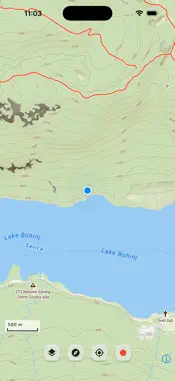
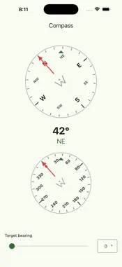
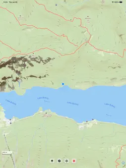
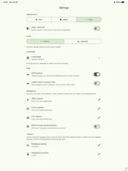
Map Wanderer is a topographic map made for the outdoors and is a great teaching aid for map and compass. An outdoor map for people who actually go outside. Plan a route before you leave, record the walk or the ride as you go, and pin what you find along the way. Everything you save lives on your phone. There is no account to make, no ads, and nothing about you is collected or sold. PLAN • Walking, cycling and hiking routes with distance, time and an elevation profile • Save routes, rename them, and load one back onto the map when you set off • Export a route or a recorded track as GPX RECORD • Background GPS tracking with live distance, pace, ascent and descent • Elevation and speed charts you can pinch to zoom • Honest stopped time: real stop detection with a stop count, and you decide what counts as stopped • Spots impossible GPS fixes and offers to correct the track rather than quietly inflating your climb • Put a saved track back on the map and walk it again MARK • Markers with notes and photos, in colour-coded categories • Photo pins sit where you took the photo • Trips, favourites, find-nearby, and MGRS grid references READ THE LAND • Hillshade relief so the terrain reads at a glance • Contours, buildings, roads, water and cycle routes as separate toggles • Tap anything on the map to identify it • A legend for every map symbol and every route colour FIELD TOOLS • Compass with a target bearing • Sunrise, sunset, solar noon and day length, plus the watch-north method • Unit converter BUILD A TRAIL Lay out a numbered trail with waypoint symbols, then share it by QR code. The other phone scans it directly. No server, no link, no sign-up. WET WEATHER GAMES Pairs, Grid Hunt, Spotter and Trails & Ladders: map-symbol games for the tent, the train or the pub. OUT AND ABOUT Walk to collect cards scattered across a play area near you. Choose the size and the rules, and share the area with a friend by QR code. YOUR DATA, YOUR RULES Everything stays on your device by default. If you want it on more than one, switch on sync to your own iCloud Drive or Google Drive, held back to Wi-Fi unless you say otherwise. You can also back the lot up to a single file and restore it later. In English, German, Spanish, French, Italian, Polish, Portuguese, Croatian, Hungarian, Slovak and Slovenian. Note: Map Wanderer draws its map and plans its routes over the network, so it needs a connection for those. Your recordings, markers and trails are always readable offline. Map data by MapTiler and OpenStreetMap. Routing by OpenRouteService. Lace up and go — Map Wanderer is ready when you are.
What's New
Version 1.1 2026-09-11
You can now turn on iCloud or Google cloud sync of your map markers and saved routes. GPS anomaly corrections - you decide if a sudden GPS drop to 0m was real o... Technical Analysis
Package Overview Basic metadata
Bundle ID
com.powerslave.wanderer Current Version 1.1
Minimum iOS 15.0
Package Size App Store Size
Package Metadata 0 / 0 version records
Detailed binary, privacy manifest, framework, and Info.plist results have not been indexed for this package yet. The verified App Store and archive metadata above remains available.
Developer Information
Known Version Records
0 version records with stored package metadata
Stored metadata does not guarantee a package is currently available to download.
| Details | Version / IDs | Version date | Action |
|---|