Preview






Description
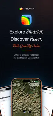
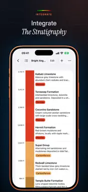
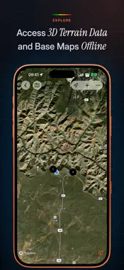
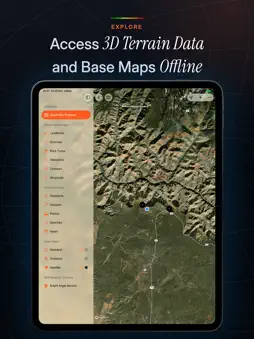
An iPad & iPhone App for Geoscientists to Collect, Integrate, Analyse, and Interpret Earth Science Data in an Applied GIS Environment. Our Simple & Smart Process An all digital workflow with an intuitive approach away from classic paper challenges and transcription errors and that integrates seamlessly into your existing systems and workflows. Step 1: Collect Any & All Observations Setup your project first, then observe the outcrop, lab results or other relevant geoscientific data, add a point on the field map, verify the positioning and document the needed information with dedicated records. No need to manually transcribe your rained-on, warped, and/or ripped paper field slips, notes, and sketches in the evening. Step 2: Integrate The Stratigraphy Create one or more stratigraphic columns. The individual units are each linked to the rocktype and contact records of the relevant observations so you can easily identify the reference observations of a unit, validate compatibility and make modifications. Step 3: Analyse & Interpret Your Geospatial Data Continuously analyse your collection of observation data, which is automatically categorised onto dedicated location and observation maps and tables upon entry. This will enable you to develop and modify your interpretation, track your progress and plan ahead. Smarter Technologies, Integrated with Care • Harness On-Device GPS To enhance your experience, device capabilities are leveraged for swift data acquisition, comprehensible visualisation and comprehensive analyses. • Compile & Store Spatial Data Each project has GIS at its core for accurate and reliable spatial data work. The data is stored in a SQLite database of the open GeoPackage format. • Access Cloudless, Hi-Res Satellite Imagery Our maps provide the advantage of seamless layers of cloudless, worldwide, high-resolution satellite imagery. • Access 3D Terrain Data Our maps also provide the advantage of 3D map visualisation, detailed terrain with elevation data, and streets, trails and labels. • Access Base Maps Offline Download regions of Mapbox maps to verify and correct your position, even in ‘dark’ spots where acquiring GPS and cellular signals are a challenge. Dedicated Records Document your observations thoroughly without forgetting any details. Each observation contains selectable and open fill forms to complete as part of a dedicated record keeping system with spatial analysis and quality assurance enhancements. Simple. Efficient. Effective. Additional features and tools you need to document your observations and drive accurate Earth systems understanding. • Manage Your Collection Gather like a squirrel nearing winter and view your data on maps, in tables and as stratigraphic columns. • Turn Complexity Into Insights Have your data automatically categorised onto dedicated location and observation maps. • Sketch & Annotate It Make sketches, annotate photos, and write free-form notes with each observation. • Have Confidence In Your Data Provide a confidence rating with each record type and build a robust dataset. ... And Much More Lithos improves over time as new features are added. Usage of Lithos is covered by the standard Apple End User License Agreement available at https://www.apple.com/legal/internet-services/itunes/dev/stdeula/
What's New
Version 1.2 2026-11-02
Alteration - New Alteration record: record the alteration type, minerals, distribution, zonal arrangement, halo size, color change, texture, intensity, paragene... Technical Analysis
Package Overview Basic metadata
Bundle ID
com.1-north.lithos Current Version 1.2
Minimum iOS 26.0
Package Size App Store Size
Package Metadata 0 / 0 version records
Detailed binary, privacy manifest, framework, and Info.plist results have not been indexed for this package yet. The verified App Store and archive metadata above remains available.
Developer Information
Known Version Records
0 version records with stored package metadata
Stored metadata does not guarantee a package is currently available to download.
| Details | Version / IDs | Version date | Action |
|---|