Preview





Description
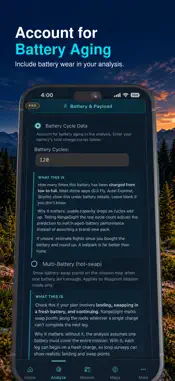
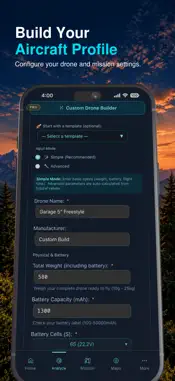
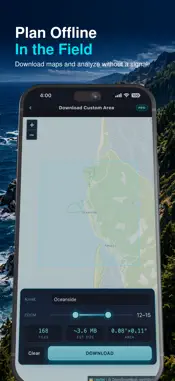
Plan drone missions with real mission-performance data before takeoff. RangeSight is a drone mission planner and preflight analysis app for commercial UAV pilots, surveyors, inspectors, public-safety teams, and serious recreational pilots. Import a planned route or choose a launch point, then model how wind, battery state, payload, aircraft performance, and reserve requirements affect expected mission performance and return margin. MISSION ANALYSIS — RANGESIGHT PRO • Import KML, KMZ, GPX, CSV, WPML, and LCHZ mission files • Analyze drone routes leg by leg and waypoint by waypoint • Review expected battery and return margin throughout the mission • See the mission result and the segment that constrains the plan • Use live weather or enter conditions manually • Model payload weight for cameras, sensors, and accessories • Plan multi-battery missions with modeled hot-swap points FREE RANGE ANALYSIS Need a quick drone range check before building a full mission? RangeIQ creates a wind-shaped range envelope from your launch point using your aircraft, battery, wind, payload, and reserve inputs. • Runs on-device • Works offline • 31 pre-configured drone profiles • Manual weather entry • No account required WEATHER & FIELD TOOLS • Live wind, gust, temperature, and weather inputs • Personal Weather Station integration • Offline map downloads for field operations • Saved launch locations • Custom Drone Builder for specialized or modified aircraft • Fine-tune calibration using observed flight performance BUILT FOR DRONE OPERATIONS RangeSight supports preflight analysis for: • Drone mapping and surveying • Corridor and infrastructure inspection • Commercial UAV field operations • Search and rescue and public-safety missions • Large-area survey and inspection routes • Demanding recreational drone flights RANGESIGHT PRO RangeSight Pro unlocks the full Mission Analysis Map, live weather, custom aircraft profiles, payload modeling, offline maps, fine-tune calibration, and advanced mission tools. New subscribers can try RangeSight Pro free for 14 days. Monthly and annual subscription options are available through the App Store. Subscriptions automatically renew unless canceled at least 24 hours before the end of the current subscription period. Manage or cancel your subscription in Apple ID > Subscriptions. IMPORTANT RangeSight provides physics-based planning estimates and decision support. It does not provide flight authorization or guarantee real-world flight outcomes. Actual performance can vary with battery condition, aircraft configuration, firmware, weather, pilot technique, and other factors. Always follow applicable regulations, manufacturer limits, and your own operational judgment. RangeSight is built by Noxdren, LLC. Terms of Use: https://www.apple.com/legal/internet-services/itunes/dev/stdeula/
What's New
Version 2.0.5 2026-10-01
Fixed an issue that prevented the dark street map from displaying correctly. Technical Analysis
Package Overview Basic metadata
Bundle ID
com.rangesight.RangeSight Current Version 2.0.5
Minimum iOS 26.2
Package Size App Store Size
Package Metadata 0 / 4 version records
Detailed binary, privacy manifest, framework, and Info.plist results have not been indexed for this package yet. The verified App Store and archive metadata above remains available.
Developer Information
Known Version Records
0 version records with stored package metadata • 4 known version records
Stored metadata does not guarantee a package is currently available to download.
| Details | Version / IDs | Version date | Action |
|---|---|---|---|
| Not archived | App Store ID: 887068411 | Unknown | Request Version |
| Not archived | App Store ID: 885900893 | Unknown | Request Version |
| Not archived | App Store ID: 885802068 | Unknown | Request Version |
| Not archived | App Store ID: 883256714 | Unknown | Request Version |