
Preview






Description
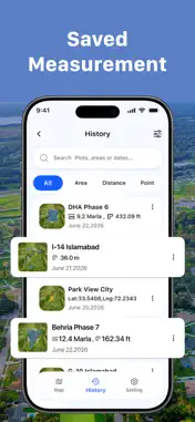
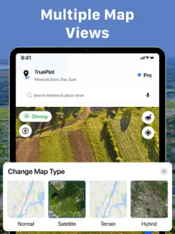
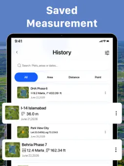
Measure any lot, field, or property in under two minutes. Search the address, tap the corners on satellite imagery, and get the area instantly — in acres, square feet, square meters or hectares. Get an accurate number before money moves — without waiting days or paying for a survey. DESIGNED FOR: • Property buyers & landowners (verify lot size before purchase, settle boundary questions) • Real estate agents & property teams (map parcels, save labeled measurements per client) • Farmers (field mapping, planning for fields, farms and plots of any shape) • Contractors & estimators (fencing, piping and irrigation estimates, construction site layout) KEY FEATURES: • GPS Field Area Measure — measure the area of any land or property by tapping points on the satellite map. Ideal for fields, farms, plots and construction sites. Drag any pin to fine-tune; the result updates live. • Walk the Boundary — walk the property line and GPS traces it in real time, with a signal-strength indicator so you know the measurement is reliable before you start, and estimated accuracy shown when you finish. • Acreage Calculator — instantly convert any measurement between acres, square feet, square meters and hectares. One tap, no settings menu. • Perimeter Measurement — total boundary length calculated with every area, so you can estimate fencing, piping or irrigation needs in seconds. • Multi-Area Measurement — measure adjacent lots or parcels on one map and see each area plus the combined total. Overlapping regions are detected and excluded automatically. • Address Search That Works — type any address or landmark and jump straight to the parcel. No endless map scrolling. SAVE, LABEL AND SHARE: • Name every measurement ("Oak Ridge Lot 4") and find it later with search • Export a one-page PDF report with the map, boundary lines, area, date and GPS coordinates • Save as image and share by text or email in seconds Perfect for checking lot size before you buy, planning fences, estimating acreage on rural land, mapping fields, or settling a boundary question fast. Download free and measure your first property today. Privacy Policy: https://trueplot.netlify.app/privacy-policy
Terms of Use: https://trueplot.netlify.app/terms-of-service Terms of Use (EULA): https://www.apple.com/legal/internet-services/itunes/dev/stdeula/
What's New
Version 1.0.5 2026-09-10
What's new in TruePlot: Field Area Measure • Performance improvements and minor bug fixes Technical Analysis
Package Overview Basic metadata
Bundle ID
com.trueplot.map.area Current Version 1.0.5
Minimum iOS 16.6
Package Size App Store Size
Package Metadata 0 / 0 version records
Detailed binary, privacy manifest, framework, and Info.plist results have not been indexed for this package yet. The verified App Store and archive metadata above remains available.
Developer Information
Known Version Records
0 version records with stored package metadata
Stored metadata does not guarantee a package is currently available to download.
| Details | Version / IDs | Version date | Action |
|---|