
Preview





Description
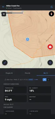
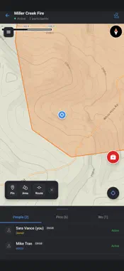
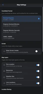
FireFront Maps is a live incident map for wildland firefighting crews. Create a map session for an incident, invite your crew with a code, and everyone sees the same picture — pins, routes, division breaks, drop points, hazards, and each other's live positions — on and off the grid. BUILT FOR THE FIELD • Shared map sessions — one map per incident, shared with your crew or a whole team; join by invite code • Pins, routes and areas — mark drop points, hazards, water sources, safety zones, divisions and fire perimeters; edits sync to everyone • Live crew locations — see where your people are during an assignment • Track Me — record your GPS track on a drive or a walk-around, even with the screen off • Offline maps — download map areas for the incident before you lose signal; everything you add while offline syncs when you're back • Uploaded maps — drop an agency IAP map or GeoPDF onto the live map as a positioned overlay • Weather observations — log belt-weather readings at your location and share them with the session • Find a coordinate — jump to any lat/long, DDM, DMS or USNG coordinate; read your own position in any format • Medical one-tap — quick access to the IWI (Incident Within an Incident) process and 8-line medical report • Radio handbooks — offline quick-reference guides for common BK radios MADE BY FIREFIGHTERS FireFront Maps is part of the FireFront suite for wildland fire contractors. Accounts are provisioned by your company in FireFront Command; this app is for crews that already have a FireFront login. Location is used to show your position on the map, record Track Me tracks, and share your live position with your session members while a session is active. Background location keeps Track Me recording while your screen is off. Privacy policy: firefront.dev/privacy
What's New
Version 1.3.1 2026-09-11
Incident maps join automatically for everyone on the fire Upload audience: everyone, my company, or only me Incident map folder from the IAP QR code, with brows... Technical Analysis
Package Overview Basic metadata
Bundle ID
dev.firefront.maps Current Version 1.3.1
Minimum iOS 16.4
Package Size App Store Size
Package Metadata 0 / 0 version records
Detailed binary, privacy manifest, framework, and Info.plist results have not been indexed for this package yet. The verified App Store and archive metadata above remains available.
Developer Information
Known Version Records
0 version records with stored package metadata
Stored metadata does not guarantee a package is currently available to download.
| Details | Version / IDs | Version date | Action |
|---|