
Preview


Description
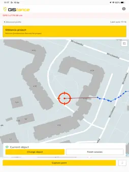
GIStance turns an iPhone plus a connected GNSS receiver into a survey-grade field capture system for infrastructure, utility and construction crews. Centimeter-level positioning, georeferenced photo documentation, and 3D LiDAR scanning — captured on site, structured for the office. Built for FTTX rollout, utility networks and construction documentation, GIStance replaces the paper-notes-plus-consumer-camera workflow with a single tool that records where every asset is, what it looked like, and when it was captured. Precise positioning • Connect an external GNSS/RTK receiver for centimeter-level accuracy • Live fix status and accuracy readout before you record a point • Positions attached to every photo, measurement and scan Georeferenced photo documentation • Capture site photos with coordinates, timestamp and accuracy embedded • Tie documentation to project sections and construction phases • Consistent, auditable evidence for as-built records and billing 3D LiDAR scanning • Capture point clouds and meshes of trenches, structures and installations • Scans stored as measurement artifacts alongside points and photos Built for the field • Works with mapped basemaps for on-site orientation • Fast capture flow designed for gloved hands and daylight screens • Data queued and synced when connectivity allows Part of a documentation ecosystem Field captures sync to the FotoGIS asset hub and become available in the GISdoc office platform for project tracking, phase completion, plan-vs-actual comparison and report generation. What the crew captures on site is what the office works with — no manual re-entry. Who it's for • Field surveyors and rollout crews • Utility and network operators • Construction documentation and as-built teams Requirements GIStance requires a compatible external GNSS receiver for survey-grade accuracy and an active GISdoc/FotoGIS account. It is a professional B2B field tool, not a standalone consumer app.
What's New
Version 1.0.11 2026-10-23
What's new Account activation directly in the app Password setup directly in the app LDAP login Measurements are blocked when GNSS accuracy is insufficient Lice...What's new Account activation directly in the app Password setup directly in the app LDAP login Measurements are blocked when GNSS accuracy is insufficient Licence storage limits are now taken into account Tenant name is now displayed Fixes Correct message when changing the password Tenants can be activated in the app again The planning layer is shown in the configured colour instead of black Initials are displayed correctly in the user icon Polygon geometries are handled correctly More reliable creation of measurement files Inactive users now see the reason when login is refused The system-generated bottom line (AUTO_BOTTOM_LINE) is no longer shown or selectable Technical Analysis
Package Overview Basic metadata
Bundle ID
eu.ngn.gistance Current Version 1.0.11
Minimum iOS 17.6
Package Size App Store Size
Package Metadata 0 / 0 version records
Detailed binary, privacy manifest, framework, and Info.plist results have not been indexed for this package yet. The verified App Store and archive metadata above remains available.
Known Version Records
0 version records with stored package metadata
Stored metadata does not guarantee a package is currently available to download.
| Details | Version / IDs | Version date | Action |
|---|