
Preview





Description
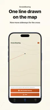
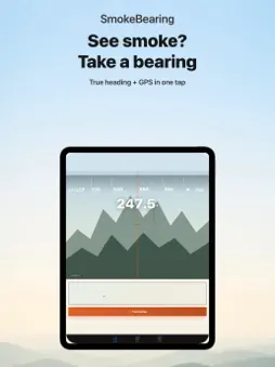
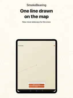
You see smoke on the horizon. Where is it? SmokeBearing answers with the same method fire lookout towers have used for a century: cross-bearings. SIGHT IT - Aim your phone at the smoke and take a bearing — true heading, GPS position and a reference photo are recorded in one tap - A bearing line is drawn on the topographic map instantly CROSS IT - Move sideways, take a second bearing, and the two lines cross - The intersection is the estimated smoke position — with an honest uncertainty fan, never a fake pinpoint - Distance from you, coordinates in decimal or DMS, ready to share READ THE WIND - Smoke drifts. The crossing point is where the smoke is now — not where the fire started - Live wind direction and speed are drawn over the map, so you can see which way the plume is running - The likely source is marked upwind of the smoke, as a zone rather than a false pinpoint WORKS ANYWHERE - No fire-data feed required: the bearing fix is measured by your phone's own compass and GPS, and works fully offline - Keep a log of every fix with photos and observation points - All data stays on your device SmokeBearing gives a rough cross-bearing estimate; error grows with distance. Always follow official emergency information for evacuation and reporting decisions. No ads, no subscription: one purchase, forever.
Technical Analysis
Package Overview Basic metadata
Bundle ID
jp.netflowers.SmokeBearing Current Version 1.0
Minimum iOS 17.6
Package Size App Store Size
Package Metadata 0 / 0 version records
Detailed binary, privacy manifest, framework, and Info.plist results have not been indexed for this package yet. The verified App Store and archive metadata above remains available.
Developer Information
Known Version Records
0 version records with stored package metadata
Stored metadata does not guarantee a package is currently available to download.
| Details | Version / IDs | Version date | Action |
|---|