
Preview






Description
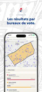
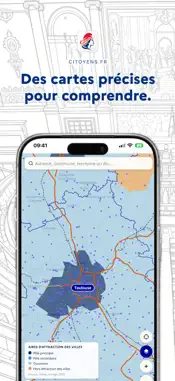
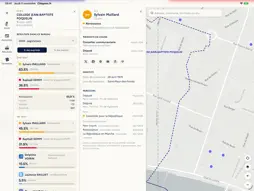
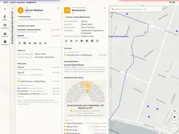
Citoyens.fr puts French democracy in your pocket. The app is in French. Independent app: Citoyens.fr does not represent the French government or any public administration, and is not affiliated with any local authority, party or candidate. The public information it shows comes from the official sources listed at the end of this description. FIND YOUR POLLING STATION Enter an address: the app finds the polling station, shows it on the map with the area of its voters, and works out the route on foot or by car. RESULTS, POLLING STATION BY POLLING STATION Presidential, parliamentary, European, municipal, regional and departmental elections since 2002: see the results of every polling station, municipality and constituency in France, as a share of votes cast or of registered voters, abstention and blank votes included. A PROFILE FOR EVERY POLLING STATION Income, age, housing, property prices, socio-professional categories, unemployment: compare each polling station with the national average, using public data from INSEE and Etalab. ELECTED OFFICIALS AND PARTIES Members of Parliament, senators, Members of the European Parliament, mayors, regional and departmental councillors: each has a profile with their career, mandates, party and links. Each party brings together its government members, MPs, senators and the main municipalities it runs. YOUR AREAS Regions, departments, municipalities and French citizens abroad: find out who represents you, the electoral history of each constituency and the key figures of each area. YOUR LOCAL AUTHORITIES' ACCOUNTS Taxes, debt and grants to associations of your municipality, department and region: the amount, per inhabitant, the year-by-year trend and how it compares with similar local authorities, from public data published by the DGFiP and the OFGL. 2027 PRESIDENTIAL ELECTION Declared candidates, a summary of their programme, their meetings on the map, and the average of all published polls. POLLS AND INSTITUTIONS Studies and opinion polls (Elabe, Ifop, Toluna), INSEE publications, the Élysée, the National Assembly, the Senate, the Constitutional Council, the Council of State and the Court of Audit: gathered in one place, each publication with its source. DATA TO UNDERSTAND Railways, power grid, power plants, wind turbines, social indicators: layer useful information onto the map. OFFICIAL SOURCES • Election results, elected officials: Ministry of the Interior, https://www.resultats-elections.interieur.gouv.fr and https://www.data.gouv.fr/fr/datasets/repertoire-national-des-elus-1/ • Polling stations and their voters’ addresses: Insee, https://www.data.gouv.fr/fr/datasets/bureaux-de-vote-et-adresses-de-leurs-electeurs/ • Population and local statistics: Insee, https://www.insee.fr • Members of Parliament: Assemblée nationale, https://data.assemblee-nationale.fr • Senators: Sénat, https://data.senat.fr • Officials’ declarations: HATVP, https://www.hatvp.fr/open-data/ • Local taxes: DGFiP, https://data.economie.gouv.fr • Local accounts: OFGL, https://data.ofgl.fr • Endorsed candidates: Conseil constitutionnel, https://www.conseil-constitutionnel.fr • Administration directory: https://lannuaire.service-public.fr • Élysée, Conseil d’État, Cour des comptes: https://www.elysee.fr, https://www.conseil-etat.fr, https://www.ccomptes.fr • Official Journal: https://www.legifrance.gouv.fr • Poll notices: Commission des sondages, https://www.commission-des-sondages.fr • Doctors, hospitals, bathing water: Ministry of Health, https://data.drees.solidarites-sante.gouv.fr and https://baignades.sante.gouv.fr • Schools and campuses: https://data.education.gouv.fr and https://data.enseignementsup-recherche.gouv.fr • Terrain, lakes and rivers: IGN, https://geoservices.ign.fr • Museums and heritage: Ministry of Culture, https://data.culture.gouv.fr • Open public data: https://www.data.gouv.fr For any electoral procedure (registration, proxy vote), the official source is https://www.service-public.fr
What's New
Version 1.4.4 2026-11-17
What's new in version 1.4.4 How MPs vote: on each MP's profile, their key votes by topic, their election, attendance, loyalty to their group and closeness to t...What's new in version 1.4.4 How MPs vote: on each MP's profile, their key votes by topic, their election, attendance, loyalty to their group and closeness to the other groups, their biography and committees. "Voir tous les votes" opens the full list, with filters by parliamentary term, topic, position and votes against their group. Parliament: tap one or more groups to see their seats, their total against the absolute majority and the list of their members. Political figures: a filter by party. Your mood: each week, pick the face that matches yours, and it appears on the map. The map adds long-distance hiking trails and French maritime zones. What's new in version 1.4.3 The map in 3D: one button tilts the map and shows the relief, contour lines and buildings in volume. Candidates' events are grouped by candidate, and the legend counts the places shown on screen. A more precise map: roads and railways drawn exactly and limited to France, precise coastlines and borders, seas in blue, place names in French. Your position appears straight away. A click on the map goes from the region to the department, then to the municipality. Community: registered citizens appear near their town hall, with their profile. What's new in version 1.4.2 Write to your representatives: your mayor, your member of parliament and your senators, and to the presidential candidates, by topic, from your profile or theirs. Your profile: "Ma ville" (municipality, department, region, city council of large cities) and "Mes représentants", with the district mayor in Paris, Lyon and Marseille. The map gets richer: • Tourism: museums of France, UNESCO World Heritage, remarkable gardens, houses of famous people, Most Beautiful Villages of France, bathing waters. • Base map: relief with mountain ranges and peaks, contour lines, natural areas (parks, state forests, rivers and lakes) and Natura 2000 sites. • Transport: cycle routes, greenways and cycle lanes. • Finances: taxes, debt and grants of each municipality, in euros per inhabitant. • Measure a distance or an area. • Get there: the route on foot, by bike, by public transport or by car to a polling station or an event. Citoyens.fr at a glance (the app is in French) • Find your polling station: it appears on the map with the area of its voters and the route to get there. • Explore results since 2002 (presidential, parliamentary, European, municipal, regional, departmental elections), by polling station, municipality and constituency. • "Partis" tab: a party's or candidate's score in every constituency and polling station. • The profile of every polling station and constituency: age, income, housing, social categories, compared with the national average. • Your areas: regions, departments, municipalities and French citizens abroad, with their elected officials and key figures. • 2027 presidential election: declared candidates, a summary of their programme and their meetings on the map. • Polls and institutions: studies and polls, INSEE, the Élysée, the National Assembly, the Senate, the Constitutional Council, the Council of State and the Court of Audit. • Share a profile in one tap. • Your citizen profile: links, your blog's feed, public or private profile, direct access to your polling station. Technical Analysis
Package Overview Basic metadata
Bundle ID
fr.citoyens.app Current Version 1.4.4
Minimum iOS 15.0
Package Size App Store Size
Package Metadata 0 / 0 version records
Detailed binary, privacy manifest, framework, and Info.plist results have not been indexed for this package yet. The verified App Store and archive metadata above remains available.
Developer Information
Known Version Records
0 version records with stored package metadata
Stored metadata does not guarantee a package is currently available to download.
| Details | Version / IDs | Version date | Action |
|---|