Preview










Description
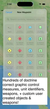
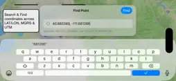
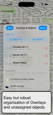
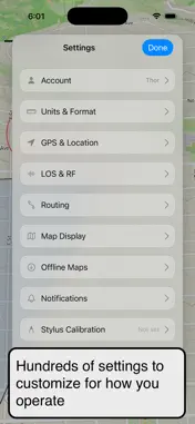
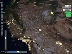
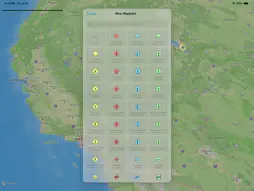
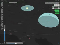
Shoot Move Communicate is a civilian Command and Control (C2) platform built around the capabilities of JBCP — designed for prepared citizens, milsim operators, search and rescue teams, and professionals who operate beyond the reach of consumer apps. MAP & NAVIGATION • Interactive map: pan, zoom, rotate, 3D pitch • Styles: Standard, Dark, Topographic, Satellite • Tracking: Free, Follow, Heading Up · Night/Light Discipline Mode (red-shift display) • Map label toggles: roads, buildings, water, POI, transit · Pencil calibration WAYPOINTS • Drop by tap or coordinate entry · drag to reposition • Friendly/unknown/hostile affiliation · custom names, icons, size, and rotation • Attach notes and photos · elevation and coordinates on demand • Point lookup — tap anywhere for coords and quick actions ROUTES • Road, Trail, Off-Road, and Custom freehand routing • Terrain-aware off-road routing via Tobler's Hiking Function • Distance, travel time, elevation gain · configurable speeds and terrain preferences LINE OF SIGHT • Observer and target placement · terrain profile with obstruction visualization • Green = clear / Red = blocked · minimum clearance calculation • Configurable heights and max range · save and export profiles WEAPON SYSTEMS • Place weapons with azimuth, left/right arc limits, and coverage ring visualization • Built-in and custom profiles: name, type, max range, effective range, default arc DRAWING & OVERLAYS • Freehand strokes (stylus or finger) with 6 colors · undo by stroke · phase line tool • Named overlay layers: group features, toggle visibility, share and export STRUCTURED REPORTS • SALUTE · Contact Report · SITREP · ACE · MIST • 9-Line MEDEVAC · 9-Line UXO/IED · CAS 9-Line · Call for Fire · BOLO • Auto-fill: sender, time, location, coordinate format · pre-fill from map features · send to team chat TEAM & COMMS • Organizations and hierarchical sub-teams · invite codes · role management • Real-time location sharing with heading and accuracy · configurable broadcast rate • Offline mesh radio via WiFi/Bluetooth — no internet required • Meshtastic LoRa radio integration for extended range • Team chat with photos and @mentions · activity banners for teammate actions TRACK RECORDING • Record, pause, resume, stop · real-time track line with elevation profile • Distance, elapsed time, elevation gain · save and export IMPORT / EXPORT • Formats: KML/KMZ, GeoJSON, GPX, SMC native • Share via AirDrop, email, Messages · import and merge SMC packages COORDINATES • MGRS (10m and 1m precision), UTM, Decimal Degrees, DTG Zulu • Global format switch applied everywhere in the app · copy to clipboard CUSTOM OBJECTS & ICONS • Upload custom images as map icons · place and reuse across the map SECURITY • Face ID / Touch ID · biometric re-auth for sensitive actions • OTP email reset · Keychain credential storage Shoot Move Communicate. The C2 platform you actually own. Terms of Use (EULA): https://www.apple.com/legal/internet-services/itunes/dev/stdeula/
What's New
Version 1.6.2 2026-09-03
OFFLINE SYNC - Fixed a bug where one change that failed to sync could block every change behind it. The retry count now survives app restarts, so a stuck change... Technical Analysis
Package Overview Basic metadata
Bundle ID
com.wtexgroup.smc Current Version 1.6.2
Minimum iOS 26.2
Package Size App Store Size
Package Metadata 0 / 0 version records
Detailed binary, privacy manifest, framework, and Info.plist results have not been indexed for this package yet. The verified App Store and archive metadata above remains available.
Developer Information
Known Version Records
0 version records with stored package metadata
Stored metadata does not guarantee a package is currently available to download.
| Details | Version / IDs | Version date | Action |
|---|