
Preview





Description
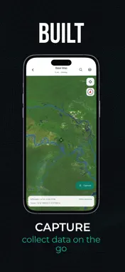
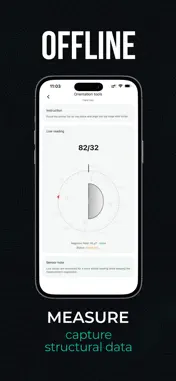
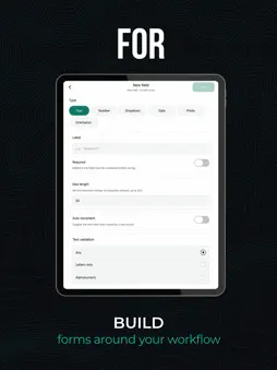
Iyari is an offline-first field data capture app built for professionals who need reliable, structured information wherever work happens. Build custom forms around your workflow, capture GPS-referenced observations, attach photos, work with maps, and keep records organized in one place, even without an internet connection. Instead of relying on paper notes, scattered files, or reorganizing information later, Iyari helps you structure and validate data as it is collected. With Iyari you can: • Create customizable field forms • Capture GPS-referenced records • Attach photos to observations • Work with maps and location-based data • Work offline in remote or low-connectivity environments • Capture structural orientation measurements using device sensors • Export structured data for review, mapping, and analysis • Reuse workflows through form templates Iyari is designed for geologists, engineers, environmental professionals, biologists, technicians, inspectors, survey teams, public works teams, and anyone who collects structured data outside the office. From field capture to organized deliverables, Iyari helps keep your data consistent, validated, and ready for what comes next. Terms of Use (EULA): https://www.apple.com/legal/internet-services/itunes/dev/stdeula/
Technical Analysis
Package Overview Basic metadata
Bundle ID
com.iyari.app Current Version 1.0.3
Minimum iOS 15.1
Package Size App Store Size
Package Metadata 0 / 0 version records
Detailed binary, privacy manifest, framework, and Info.plist results have not been indexed for this package yet. The verified App Store and archive metadata above remains available.
Developer Information
Known Version Records
0 version records with stored package metadata
Stored metadata does not guarantee a package is currently available to download.
| Details | Version / IDs | Version date | Action |
|---|