Preview

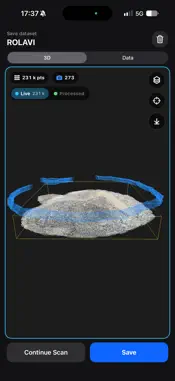
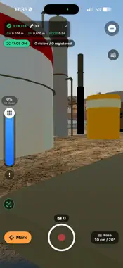
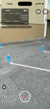


Description
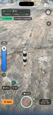
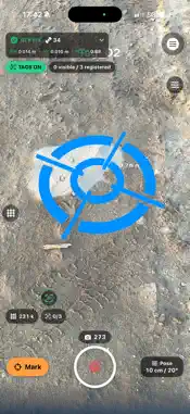
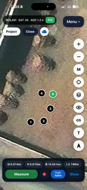
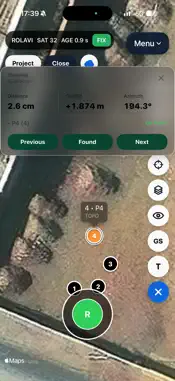
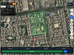
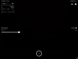
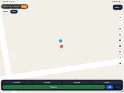
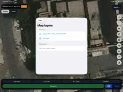
ROLAVIScan is a professional field application for GNSS surveying, RTK positioning, LiDAR scanning, augmented reality, terrestrial photogrammetry and geospatial project management on iPhone and iPad. Built for surveyors, engineers, construction professionals, geodesists and field teams, ROLAVIScan brings capture, stakeout, measurement, reconstruction and visualization tools into one mobile workflow. GNSS AND RTK • Connect supported ROLAVI, SparkPNT TX2, DataGNSS NANO RTK and UM980 Bluetooth receivers • Use NTRIP corrections for RTK positioning • Connect external NMEA sources through TCP • Use iPhone GPS as an approximate SINGLE-position source • View solution status, satellites used and visible, skyplot, signal bars, HDOP, VDOP, correction age and accuracy • Record raw GNSS data with supported ROLAVI receivers SURVEYING • Capture survey points with names, codes and instrument height • Perform point stakeout and review distances and direction • Apply geoid models and Grid Shift corrections • Import and export CSV survey data • Display DXF, KML, KMZ, SHP ZIP and WMS layers • Work with LandXML terrain surfaces and georeferenced raster data • Organize survey points, photos, point clouds and exports by project LIDAR AND POINT CLOUDS • Capture color point clouds and mesh data on compatible LiDAR devices • Preview, process and manage field scans • Export professional point-cloud and 3D formats for further processing AUGMENTED REALITY • Visualize and stake out georeferenced points in AR • Measure AR points, polylines and polygons • Place ROLAVIAR models • Create and inspect AR pipelines and AR polygons • Use shared GNSS/AR calibration for geospatial visualization PHOTOGRAMMETRY AND 3D • Capture georeferenced photo sets • Process on-device photogrammetry projects • Preview and export reconstructed models, including USDZ workflows • Generate georeferenced 3D Gaussian Splatting projects • Export Gaussian models and colored LAS point clouds ROLAVISCAN PRO ROLAVIScan Pro is a single auto-renewable subscription that unlocks the complete compatible workflow, including supported non-ROLAVI Bluetooth receivers, iPhone GPS, TCP NMEA, Surveying, AR, Camera–LiDAR, Photogrammetry and 3D Gaussian Splatting. Monthly and annual plans are available. The subscription title, duration, included services and localized price are displayed before purchase. Payment is charged to your Apple Account after confirmation. Subscriptions renew automatically unless cancelled at least 24 hours before the end of the current period. You can manage or cancel your subscription in Apple Account settings. Restore Purchases is available inside the app. Some functions require compatible GNSS hardware, a LiDAR-equipped Apple device, internet access for NTRIP or sufficient device storage and processing capacity. Privacy Policy: https://rolavignss.github.io/rolaviscan-privacy/ Terms of Use — Apple Standard EULA: https://www.apple.com/legal/internet-services/itunes/dev/stdeula/
What's New
Version 1.0.5 2026-11-03
New • AR Design menu • AR Point Stake with an approach target (bull's-eye) to guide you to each point • New 3D viewer for photogrammetry, 3DGS and LiDAR scans •... Technical Analysis
Package Overview Basic metadata
Bundle ID
ROLAVI-GNSS.ROLAVIScan Current Version 1.0.5
Minimum iOS 18.6
Package Size App Store Size
Package Metadata 1 / 1 version records
Detailed binary, privacy manifest, framework, and Info.plist results have not been indexed for this package yet. The verified App Store and archive metadata above remains available.
Developer Information
Known Version Records
1 version record with stored package metadata
Stored metadata does not guarantee a package is currently available to download.
| Details | Version / IDs | Version date | Action |
|---|---|---|---|
| 11.33 MB | v1.0.3 App Store ID: 886903521Build: 1.0.3 | 2026-07-30 18:57:15 | Get Version |