
Preview





Description
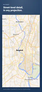
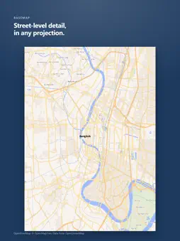
Every flat map of a round world distorts something: area, shape, distance or direction. You cannot avoid it, only choose what to give up. GeoCanvas lets you watch that choice being made. Switch between 55 projections, turn the globe, and see exactly what each one gives away. EXPLORE • The familiar: Mercator, Robinson, Winkel Tripel, Equal Earth, Mollweide, Natural Earth, Albers • The rarely rendered: Waterman butterfly, Peirce Quincuncial, Airocean, Berghaus star, tetrahedral Lee, interrupted Mollweide • Cylindrical, pseudocylindrical, azimuthal, conic, polyhedral and interrupted families, side by side • Rotate and re-centre a projection, and watch the distortion follow the viewpoint • Search any place, or jump to where you are with My location BUILD • Vector, raster and terrain layers, as many as you like on one map • Colour a layer by category or by value in a few taps, with ready-made colour ramps • Draw on the map directly with parametric tools • Symbology, labels and legends • Isolines and relief shading IMPORT • Bring your own GeoJSON or zipped Shapefile • The coordinate system is read from the .prj and converted for you, with an honest note on how exact the conversion is EXPORT • PNG, JPEG, TIFF, SVG and GeoJSON • Print sizes up to A3 at 300 dpi, or set your own dimensions • CMYK separation for press work, from a measured profile rather than a guess • Leave the geocanvas.app wordmark off: only the data credits stay WHO IT IS FOR Geography teachers explaining why Greenland is not the size of Africa. Cartographers prototyping a layout. Students, journalists, designers, and anyone who has looked at a world map and felt something was off. One purchase, no ads. Optional: an auto-renewable monthly AI subscription for more and longer conversations with the map assistant. GeoCanvas runs on open data, including Natural Earth. Terms of Use (EULA): https://www.apple.com/legal/internet-services/itunes/dev/stdeula/
What's New
Version 1.8.0 2026-11-11
iOS scroll bug fixed. Stabilty updates for better user experience. Technical Analysis
Package Overview Basic metadata
Bundle ID
app.geocanvas.ios Current Version 1.8.0
Minimum iOS 18.0
Package Size App Store Size
Package Metadata 0 / 0 version records
Detailed binary, privacy manifest, framework, and Info.plist results have not been indexed for this package yet. The verified App Store and archive metadata above remains available.
Known Version Records
0 version records with stored package metadata
Stored metadata does not guarantee a package is currently available to download.
| Details | Version / IDs | Version date | Action |
|---|