
Preview










Description
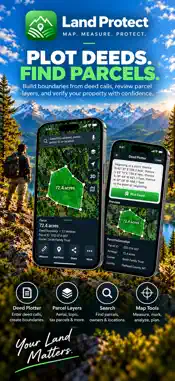
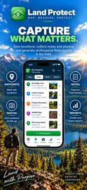
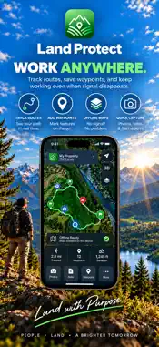
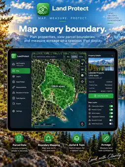
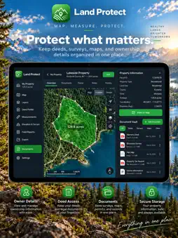
Land Protect is a professional land surveying app for iPhone and iPad. Map your property boundaries with GPS precision, calculate area and perimeter, record survey markers with photos, and export to industry formats — all without a subscription. FEATURES • Live GPS boundary mapping on satellite, topo, and street maps • Accurate area calculation in acres, hectares, sq ft, or sq meters • Full perimeter with per-segment bearings in DMS format • Drag-and-drop survey markers for precise placement • Built-in compass with true/magnetic heading and inclinometer • Marker photos — attach site photos to each boundary point • Multiple survey projects with full CRUD management • Export to CSV, KML (Google Earth), GeoJSON, DXF (AutoCAD), and survey report TXT • USGS Topo, USGS Imagery, National Map, OpenStreetMap overlays • Fully offline after map tiles are cached — no internet required for GPS SURVEY-GRADE TOOLS Land Protect uses CoreLocation for high-accuracy GPS (±3m typical), the Haversine formula for geodetic distance, and the Shoelace theorem for polygon area — the same math used by professional surveyors. PRIVACY All survey data stays on your device. No account required. No data sent to servers. No analytics. No ads. Ever. "Know your boundaries." ``` https://www.apple.com/legal/internet-services/itunes/dev/stdeula/
What's New
Version 8.0.4 2026-10-14
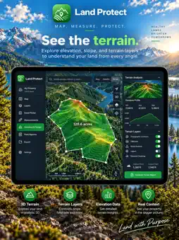
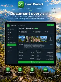
Land Protect has grown into a more powerful land intelligence, mapping, measurement, and fieldwork platform. What’s new: • Improved GPS/GNSS tools with precis...Land Protect has grown into a more powerful land intelligence, mapping, measurement, and fieldwork platform. What’s new: • Improved GPS/GNSS tools with precision point capture, averaging, accuracy monitoring, external GNSS support, advanced stakeout, and field navigation. • Enhanced Deed Plotter with automatic starting-corner capture, improved deed-call parsing, WGS-84 calculations, closure analysis, bearing correction, deed scanning, and live map previews. • Expanded LiDAR tools for supported iPhone and iPad models, including two-point measurements, height, horizontal and vertical distance, slope, grade, 3D scanning, point clouds, and improved Live LiDAR Depth. • Upgraded Live LiDAR Depth with corrected orientation, camera/depth/overlay modes, tap-to-measure targeting, confidence filtering, range controls, freeze mode, scene statistics, snapshots, and saved depth observations. • New terrain and elevation tools using available elevation data for profiles, slope analysis, drainage insights, high/low points, road planning, and 3D property visualization. • New property planning tools for setbacks, buildable-area screening, easements, rights-of-way, transmission and utility corridors, property crossings, split acreage, road/driveway planning, and fence planning. • Added traverse surveying tools with closure calculations and optional Bowditch adjustment. • Expanded field evidence tools with monument records, multiple photos, reference ties, notes, voice recordings, inspections, documents, and geotagged observations. • Added property track recording for walking routes, distance, elevation, and field activity. • Expanded import and export support, including project packages, CSV, KML, GPX, GeoJSON, DXF, LandXML, GeoPackage, MBTiles, PDF reports, geospatial PDFs, and LiDAR point-cloud formats. • Added professional project quality checks to identify closure issues, missing evidence, poor GPS accuracy, incomplete records, and other items before export. • Added offline mapping and expanded project portability for fieldwork without reliable cellular service. • Added parcel and GIS tools, including configurable ArcGIS layer support and expanded map-layer management. • Added document and plat tools, including deed/plat scanning, OCR-assisted extraction, georeferencing, and optional on-device document analysis on supported devices. • Added team and field-workflow features including tasks, nearby project sharing, optional team location tools, and Apple Watch companion support. • Improved app navigation, Field Tools layout, map workflows, address search behavior, performance, reliability, and compiler compatibility. • Numerous fixes and refinements throughout the app, including improved data persistence, backward compatibility, privacy handling, App Store readiness, and field-tool usability. Land Protect continues to combine GPS, GNSS, LiDAR, deed plotting, terrain analysis, parcel intelligence, offline mapping, and professional reporting in one field-ready app. Note: Land Protect provides mapping, measurement, and field-reference tools. Property boundaries and measurements should not be treated as a substitute for a legally authoritative land survey. Technical Analysis
Package Overview Basic metadata
Bundle ID
org.spectredatasolutions.app Current Version 8.0.4
Minimum iOS 17.0
Package Size App Store Size
Package Metadata 0 / 4 version records
Detailed binary, privacy manifest, framework, and Info.plist results have not been indexed for this package yet. The verified App Store and archive metadata above remains available.
Developer Information
Known Version Records
0 version records with stored package metadata • 4 known version records
Stored metadata does not guarantee a package is currently available to download.
| Details | Version / IDs | Version date | Action |
|---|---|---|---|
| Not archived | App Store ID: 884631941 | Unknown | Request Version |
| Not archived | App Store ID: 884369458 | Unknown | Request Version |
| Not archived | App Store ID: 884118047 | Unknown | Request Version |
| Not archived | App Store ID: 883712911 | Unknown | Request Version |