
Preview
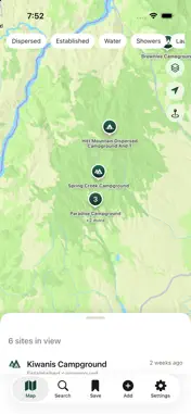


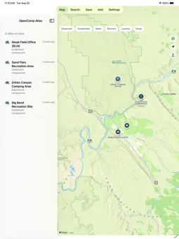
Description
Find legal camping. Know before you go. OpenCamp Atlas maps over 16,000 public-land camping locations from U.S. Forest Service and Bureau of Land Management records, plus traveler amenities from OpenStreetMap. Every site says where its information came from and how confident that information is, because a campsite you cannot legally use is worse than no campsite at all. HONEST LEGAL STATUS Sites are labeled by how sure we are: confirmed by an agency source, likely legal, or unknown. The app never presents a guess as a fact, and never invents a "primitive" designation the agency record didn't actually give. ROUTING THAT KNOWS YOUR RIG Enter your vehicle's height, width, length, and weight, and routes account for your vehicle profile. Leave a dimension blank and the app says plainly that clearance wasn't checked — a wrong height is more dangerous than no height, so nothing is ever assumed. WEATHER, INCLUDING ALONG YOUR ROUTE Official National Weather Service forecasts and active alerts for the site you're viewing — and for a planned route, the weather at points along the way, not just the destination. A four-hour drive can end somewhere very different from where it started. ACTIVE WILDFIRE AWARENESS See real fires near a site, along a route, or on the map, with size and containment — sourced from the National Interagency Fire Center. Prescribed burns are never shown as wildfires. This is situational awareness, not an evacuation order: always follow official closures and agency instructions. LIVE WEATHER RADAR Real NEXRAD radar drawn on the map, never cached — a radar image from an hour ago over a storm is worse than none at all. WORKS WITHOUT SIGNAL The full site catalogue ships inside the app, so browsing and searching work with no bars. Download topographic map regions before you lose service. YOUR DATA STAYS YOURS No sign-up. Saved sites, notes, trips, and vehicle photos never leave your phone. If you choose to submit a review, only the review itself is sent — checked by a moderator before anyone else sees it. No analytics, no ads, no data sales, no tracking. Whether you're full-time in a van, weekending in a truck camper, or planning a longer trip through public land, OpenCamp Atlas is built around one question before every other feature: am I actually allowed to sleep here? --- Data sources: U.S. Forest Service, Bureau of Land Management, USGS, National Weather Service, NOAA NEXRAD (Iowa Environmental Mesonet), National Interagency Fire Center — all public domain. Amenity points from OpenStreetMap (ODbL). Routing by TomTom.
What's New
Version 1.1.0 2026-09-16
This update fixes a few bugs and adds some small improvements: • Fixed the map's site list sheet not sliding open on some devices • Map layer settings (map typ...This update fixes a few bugs and adds some small improvements: • Fixed the map's site list sheet not sliding open on some devices • Map layer settings (map type, overlays) are now remembered between launches • Fixed a bug where adding a point could save it at your current location instead of where you tapped it on the map • You can now delete saved points • Tap a weather warning or wildfire outline on the map to see details • Wildfire boundaries are now shown on the map, not just markers Technical Analysis
Package Overview Basic metadata
Bundle ID
com.opencampatlas.ios Current Version 1.1.0
Minimum iOS 17.0
Package Size App Store Size
Package Metadata 0 / 0 version records
Detailed binary, privacy manifest, framework, and Info.plist results have not been indexed for this package yet. The verified App Store and archive metadata above remains available.
Developer Information
Known Version Records
0 version records with stored package metadata
Stored metadata does not guarantee a package is currently available to download.
| Details | Version / IDs | Version date | Action |
|---|