Preview







Description
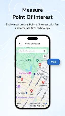
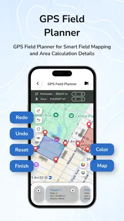
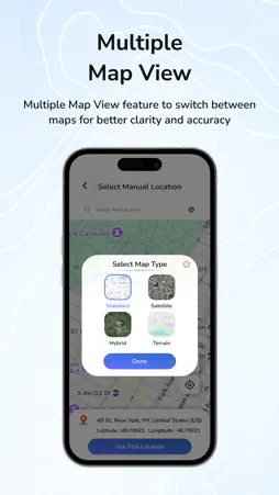
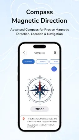
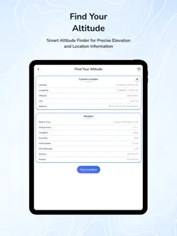
Now easy to improve your measurements with GPS Fields And Land Area Measure application. This app helps you to accurately measure areas and distances, pick locations, and generate KML reports. Whether you're surveying land, planning projects, or simply exploring new territories, This app has you covered. GPS Fields & Land Area Measure application have advanced measuring tools that make it easy to capture accurate measurements in real-time. Here you can easily take measurements of any floor plan or land, regardless of the shape. as well as you can saves your measurement history, making it easy to reference previous measurements and keep track of your projects. Now no need of physical tools to measure GPS area, here you can easily measure land area, fields, or distance using just your phone. Easy to calculate land area, field size, and distances on the map using GPS. Whether you're walking around a plot or dropping points on the map, get accurate measurements in seconds. Perfect for farmers, contractors, real estate agents, outdoor professionals, hikers, and surveyors, this tool gives you control over your land and space with just a few taps. Easily calculate area, distance, and land size using different kind of map view like satellite, hybrid, normal map. # About Key Features :- + GPS Fields Area Measurements + Distance Measure + Field Planner + GPS Stamp Camera + Find Altitude + Point Of Interest + KML File Viewer + Mock GPS Location + GPS Route Planner + Find Your Location + GPS Compass # About Features :- * Land Area Measure helps to accurately determine the area of any location. * Distance Measure easily Measure distances using manual or GPS methods. * Calculate point-to-point distances on the map screen and view total distances and choose from multiple distance units for convenience. * Measure multiple GPS area at the same time. * Multiple Units Support to measure land in acres, hectares, square meters, square feet, kilometers, and miles. * Save your measured distances for quick access and share with friends. * Show all measurements history here for future use. * Field Planner helps to farmers, surveyors, or anyone showcasing land for draw, edit & share land projects. * Using GPS Stamp Camera you can add location stamp with latitude, longitude and current location address on photos. * A customise GPS Stamp with background change, font style and color change. * Smart GPS Altitude features for hiking and climbing in real-time GPS meter. * Add point of interested (POI) area on map. * KML Import analyse your measured data with detailed reports for further analysis. * Find perfect route for your destination place with GPS Route Navigation with source and destination address. * Quickly show current or specific locations to show exactly where you are. * Compass to enhance the accuracy and convenience of your measurements in the field for easily find accurate directions. * Multiple map types supported satellite, hybrid, and normal maps Now easily turn your phone into a professional measurement tool with GPS Fields & Land Area Measure for perfect and better measurements!
What's New
Version 2.0 2026-09-01
Thanks for staying with us! The latest update includes : * GPS Area Measurement features updated. * Weather details and rain alert features added. * Tractor an... Technical Analysis
Package Overview Basic metadata
Bundle ID
shadowphoto.gpsroutefinder.videoeditor Current Version 2.0
Minimum iOS 17.6
Package Size App Store Size
Package Metadata 0 / 3 version records
Detailed binary, privacy manifest, framework, and Info.plist results have not been indexed for this package yet. The verified App Store and archive metadata above remains available.
Developer Information
Known Version Records
0 version records with stored package metadata • 3 known version records
Stored metadata does not guarantee a package is currently available to download.
| Details | Version / IDs | Version date | Action |
|---|---|---|---|
| Not archived | App Store ID: 883304872 | Unknown | Request Version |
| Not archived | App Store ID: 881461331 | Unknown | Request Version |
| Not archived | App Store ID: 827622339 | Unknown | Request Version |