Preview




Description
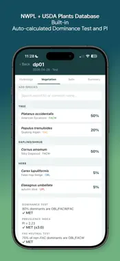
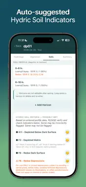
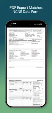
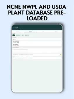
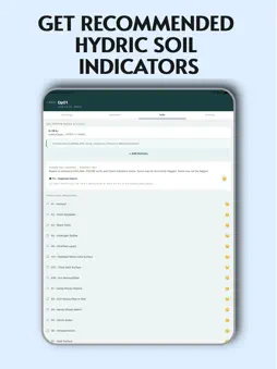
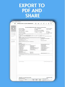
Aquod is a field data entry app for completing the USACE Northcentral and Northeast Region Wetland Determination Data Form (Version 2.0). Built by a Professional Wetland Scientist for wetland professionals on a budget! It replaces paper forms with a structured digital workflow that is offline-first — no account required, and your field data never leaves your device. WHAT AQUOD DOES - Create projects and add multiple sample plots per site - Enter field data across four tabs per plot: Hydrology, Vegetation, Soils, and Summary - Edit or remove any saved soil horizon or vegetation species entry at any time — no need to delete and re-enter to make a correction - Auto-calculates dominance test, prevalence index, and FAC-neutral test from entered vegetation data - Suggests hydric soil indicators (A1–F22) based on entered horizon data, evaluated against USDA NRCS Field Indicators of Hydric Soils v9.3 (2026) - Flags warning indicators (A17, A18, S6, S8, F8, F10, F12, F19, F21, F22) that require field confirmation, landform context, or regional restriction verification before use - Optionally pulls PLSS (Section/Township/Range), soil map unit, NWI classification, and MLRA from public federal data sources using your device's GPS — a quick starting point you review and correct, not a substitute for field verification - Generates a multi-page PDF that mirrors the official USACE NCNE v2.0 form layout, ready to attach to a Joint Permit Application or project report - Export via AirDrop, Files, email, or any share sheet destination PLANT DATABASE Primary: 2,860-species NCNE National Wetland Plant List (USFWS, 2024 edition), with Great Lakes subregion adjustments. Fallback: 37,109-species USDA PLANTS database. Species not on the NCNE NWPL default to UPL. SOIL INDICATOR ENGINE Hydric soil indicator suggestions are evaluated against USDA NRCS v9.3 (2026) criteria, covering all applicable A, S, and F indicators for loamy, clayey, sandy, and organic textures. Indicators requiring visual confirmation, landform context, regional restriction, or confirmatory field tests are flagged with a warning rather than auto-checked. Tap any info button for full v9.3 criteria and field notes. FORM COVERAGE Full coverage of the NCNE v2.0 data form: project and site header, all hydrology primary and secondary indicators with depth fields, all four vegetation strata, all soil profile fields (up to 12 horizons with matrix and redox data, each editable after saving), all standard and problematic hydric indicators, summary of findings, and final wetland determination. PRIVACY No backend, no account, no telemetry of your field data. All field data is stored locally in SQLite on your device and is never transmitted anywhere. The one exception is an optional "Pull Site Data" feature: when you explicitly tap it, the app sends only your GPS coordinates — never your field data — to public federal data services (BLM, USFWS, USDA) and a third-party host of an NRCS dataset for MLRA, to suggest values for your plot. The only other data collected from Aquod is standard Apple App Store analytics — crash reports, performance diagnostics, and download counts — handled entirely by Apple's platform. Your data stays on your device unless you choose to export or share it. SCOPE & DISCLAIMER This version covers the USACE Northcentral and Northeast Region (NCNE) only. iOS only. For professional use by qualified wetland scientists. Aquod has not been reviewed, approved, or endorsed by the U.S. Army Corps of Engineers, USDA NRCS, or any other federal or state agency, and no such review or approval has been sought or is implied. Aquod is a field data entry tool and does not replace professional judgment or constitute a formal wetland delineation. Aquod is not responsible or liable for the manner in which information is collected, stored, distributed, relied upon, or otherwise used by the user or any third party after it is exported from the app.
What's New
Version 1.1.0 2026-11-09
v1.1.0 - New: Pull Site Data - use your device's GPS to suggest PLSS (Section/Township/Range), soil map unit, NWI classification, and MLRA from public federal d... Technical Analysis
Package Overview Basic metadata
Bundle ID
com.serpentinitic.aquod Current Version 1.1.0
Minimum iOS 15.1
Package Size App Store Size
Package Metadata 0 / 4 version records
Detailed binary, privacy manifest, framework, and Info.plist results have not been indexed for this package yet. The verified App Store and archive metadata above remains available.
Developer Information
Known Version Records
0 version records with stored package metadata • 4 known version records
Stored metadata does not guarantee a package is currently available to download.
| Details | Version / IDs | Version date | Action |
|---|---|---|---|
| Not archived | App Store ID: 886064345 | Unknown | Request Version |
| Not archived | App Store ID: 885496277 | Unknown | Request Version |
| Not archived | App Store ID: 885409604 | Unknown | Request Version |
| Not archived | App Store ID: 884831365 | Unknown | Request Version |