
Preview




Description
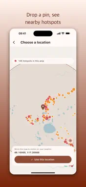
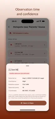
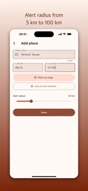
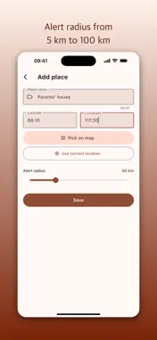
Some places matter to you but are too far away to check every day. Your parents' house, a weekend farm, a cabin, a campsite. FireNear watches them for you. It reads NASA satellite observations (FIRMS VIIRS 375m) and alerts you when a heat source is detected within the radius of a place you registered. ■ How it works 1. Add a place to watch. Drop a pin on the map or enter coordinates directly. 2. Set the alert radius, anywhere from 5 km to 100 km. 3. When a heat source is detected inside that radius, you get a notification telling you the direction and distance. ■ Features · Watch up to 10 places · Per-place alert radius (5-100 km) · Pick locations on a map, with nearby hotspots shown as you browse · Distance, bearing, confidence and observation time for every hotspot · Open any hotspot location in your map app · English and Korean, with dark mode · Works anywhere in the world ■ Important: please read What this app reports is a heat source detected by satellite. It is NOT confirmed to be a wildfire. Steel mills, power plants, agricultural burning and solar reflection can all register as heat sources. · This app is not an official emergency alert from any government or fire authority. · Satellites pass overhead only a few times a day, so detection can lag hours behind an actual fire. · Heavy cloud cover can prevent detection entirely. · For any real emergency decision, including evacuation, follow your local fire service and official alerts. Treat this as a reason to go check on a place, not as a precise early warning system. ■ Privacy The coordinates you enter are stored only on your device. Nothing is sent to or collected by a server. No account, no sign-in. Location permission is used only when you tap "Use current location" - the app never asks just because you opened it. ■ Data sources NASA FIRMS (Fire Information for Resource Management System) VIIRS 375m near real-time observations (NOAA-20) Maps: OpenStreetMap contributors Contact: [email protected]
Technical Analysis
Package Overview Basic metadata
Bundle ID
com.enoo.firenear Current Version 1.0.0
Minimum iOS 15.0
Package Size App Store Size
Package Metadata 0 / 0 version records
Detailed binary, privacy manifest, framework, and Info.plist results have not been indexed for this package yet. The verified App Store and archive metadata above remains available.
Developer Information
Known Version Records
0 version records with stored package metadata
Stored metadata does not guarantee a package is currently available to download.
| Details | Version / IDs | Version date | Action |
|---|