
Preview





Description
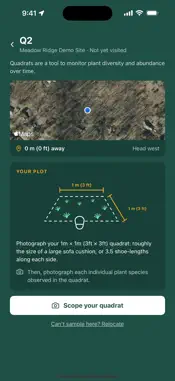
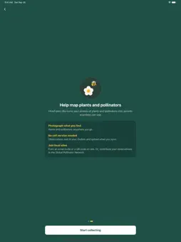
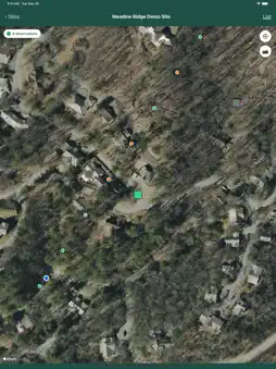
HiveTracks Bio turns a smartphone into a standardized field instrument for measuring land condition. Walk a site. Record a quadrat or a transect. Photograph what you find. Every observation is geotagged, timestamped and structured at the point of capture, so the record holds up when someone asks where the number came from. WHO IT IS FOR • Ecologists and environmental consultants running baseline and repeat monitoring surveys • Farmers and growers evidencing habitat work across fields and margins • Beekeepers and citizen scientists contributing observations from their own patch • Site managers on solar, brownfield, remediation and development land WHAT YOU CAN DO • Join a survey site with a code • Record quadrats and transects against a consistent protocol • Capture plant and pollinator observations with photos • Work offline and sync when you have signal • Review the survey history for any site and see how it has changed Survey sites are created and configured on the HiveTracks web platform. Photos you capture feed AI-assisted species identification with human verification behind it, also reviewed on the web platform. WHY THE PROTOCOL MATTERS Most land data is collected differently by every surveyor, which makes results impossible to compare between sites or across years. HiveTracks Bio applies one method everywhere. That is what turns a set of observations into a baseline you can measure change against, rather than a report that describes one afternoon. YOUR DATA Observations recorded on an organization's site belong to that organization and are visible only to that organization. Observations you record on your own land remain yours. Shared data is anonymized and location is rounded before aggregation. Photos are processed by a third-party species identification service. Full detail is in our privacy policy. ABOUT HIVETRACKS HiveTracks builds ground-truth land intelligence from field observations contributed across 145 countries. That data underpins the Land Risk Index, a site-level measure of land condition benchmarked against comparable sites. Free to use. Requires an account.
What's New
Version 1.4.3 2026-11-04
The map's sync button now shows how many records are waiting, and goes away once they're synced. The map opens on your location. Photos on a Plants transect sta...The map's sync button now shows how many records are waiting, and goes away once they're synced. The map opens on your location. Photos on a Plants transect start on Plant. Technical Analysis
Package Overview Basic metadata
Bundle ID
com.hivetracks.bio Current Version 1.4.3
Minimum iOS 16.4
Package Size App Store Size
Package Metadata 0 / 0 version records
Detailed binary, privacy manifest, framework, and Info.plist results have not been indexed for this package yet. The verified App Store and archive metadata above remains available.
Developer Information
Known Version Records
0 version records with stored package metadata
Stored metadata does not guarantee a package is currently available to download.
| Details | Version / IDs | Version date | Action |
|---|