Preview


Description
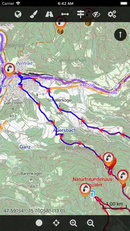
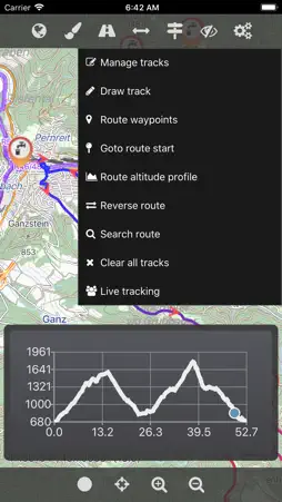
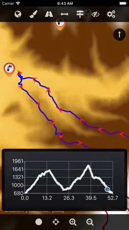
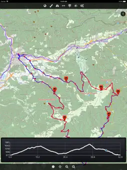
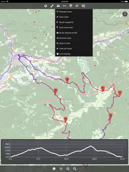
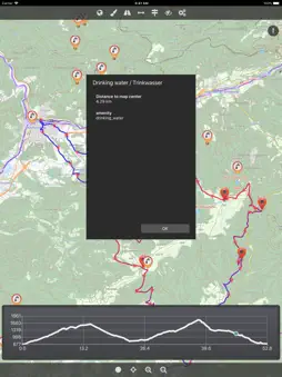
The Cartograph Lite app views Mapsforge offline vector maps, offline raster maps, and online/WMS maps. It supports tracking, route search, overlays, hillshading, reliefs, track drawing, and has many other features. Pro-version: https://itunes.apple.com/us/app/cartograph-2-maps/id1082995961?ls=1&mt=8 ### Lite Version Features ### - View Mapsforge offline vector maps. - Offline raster maps: Locus SQLite maps, MBTiles, TwoWays/CompeGPS RMAP*, Oruxmaps SQLite*. - Online map support (including WMS - Web Map Service maps), e.g. OpenStreetMap, OpenCycleMap, OpenSeaMap, WikiMedia hillshading. - GPX import and export (basic KML import support). - Scalable interface (e.g. to increase button sizes). - Units: Celsius, Kelvin, Fahrenheit, metric, imperial, nautic. - WaterSupply.at drinking water sources. - Worldwide, free offline maps. - Contour lines (Mapsforge maps). ### Additional Pro Features ### - GPS Track recording. - Full support for Mapsforge styling/render themes (including hillshading) and layers. - Custom online map sources. - Offline hillshading (from HGT/SRTM elevation data). - Offline relief shading. - Offline slope map. - Support for Mapsforge multi-maps (multiple .map files stitched into a single map). - Night/day mode. - Manual track drawing and editing. - Route altitude profile and elevation/slope visualization. - Online route search. - Live tracking and polling (using custom server, GPSies.com, or Cartograph server). - Support for Mapsforge POIs, offline POI search, and dynamic POI loading. - Compass. - Decimal and degree coordinate modes. - Customizable user interface color (dark, light, and colors) and size. - Strava upload. * RMAP and Oruxmaps use various map projections and support is experimental. Please contact us if a map does not work so that we can add support for your projection. Further information: http://www.cartograph.eu Getting started: https://www.cartograph.eu/gettingstarted Help&Tutorial: https://www.cartograph.eu/docs User manual: http://www.cartograph.eu/downloads/usermanual_en.pdf YouTube how-to videos: https://www.youtube.com/watch?v=dn9EOg5h3yY&list=PLP8X6xYv-qCz46hplsfGLW1LNgywBZrTk Full version: https://itunes.apple.com/us/app/cartograph-2-maps/id1082995961?ls=1&mt=8 Drop us a line if you have questions, feature requests, or other comments: http://www.cartograph.eu/contact ### Maps ### - OpenAndroMaps.org: very good maps for outdoor activities.
What's New
Version 2.6.0 2020-01-02
Bug fixes. Technical Analysis
Package Overview Basic metadata
Bundle ID
eu.cartograph.lite Current Version 2.6.0
Minimum iOS 11.0
Package Size App Store Size
Package Metadata 1 / 5 version records
Detailed binary, privacy manifest, framework, and Info.plist results have not been indexed for this package yet. The verified App Store and archive metadata above remains available.
Developer Information
Known Version Records
1 version record with stored package metadata • 5 known version records
Stored metadata does not guarantee a package is currently available to download.
| Details | Version / IDs | Version date | Action |
|---|---|---|---|
 46.05 MB | v2.6.0 App Store ID: 834193715Build: 1 | 2020-01-01 23:50:42 | Get Version |
| Not archived | App Store ID: 832412633 | Unknown | Request Version |
| Not archived | App Store ID: 832375709 | Unknown | Request Version |
| Not archived | App Store ID: 826956146 | Unknown | Request Version |
| Not archived | App Store ID: 824714345 | Unknown | Request Version |