
Preview
Description
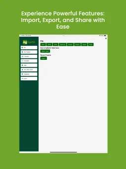
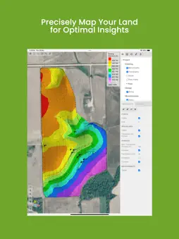
Agearth: Agriculture Topography Mapping and Tracking Agearth is a cutting-edge app designed to revolutionize agriculture through advanced topography mapping and tracking. Whether you're a farmer, agronomist, or land surveyor, Agearth provides accurate insights and powerful tools to optimize your land usage, enhance productivity, and make data-driven decisions. Key Features: Topography Mapping: Generate detailed topographic maps of your agricultural land with pinpoint accuracy. Land Analysis: Assess elevation, slopes, and drainage patterns to plan irrigation and crop placement effectively. Field Tracking: Monitor changes over time to evaluate the impact of your farming practices. Resource Optimization: Use mapping data to allocate resources like water and fertilizers more efficiently. GPS Integration: Navigate and track precise field boundaries and locations. Real-Time Updates: Get instant insights and reports to adapt quickly to changing conditions. Data Export: Share and integrate your mapping data with other tools and platforms for seamless farm management. Agearth is the perfect solution for maximizing land potential, improving resource management, and achieving sustainable farming goals. Download now to elevate your agricultural practices!
Technical Analysis
Package Overview Basic metadata
Bundle ID
com.agzone.earth Current Version 1.0
Minimum iOS 14.0.0
Package Size App Store Size
Package Metadata 0 / 1 version records
Detailed binary, privacy manifest, framework, and Info.plist results have not been indexed for this package yet. The verified App Store and archive metadata above remains available.
Known Version Records
0 version records with stored package metadata • 1 known version records
Stored metadata does not guarantee a package is currently available to download.
| Details | Version / IDs | Version date | Action |
|---|---|---|---|
| Not archived | App Store ID: 866233368 | Unknown | Request Version |