Preview




Description
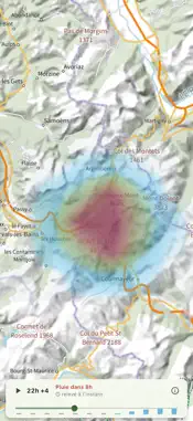
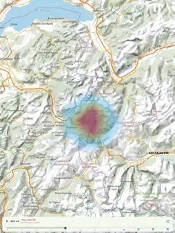
Rando.Météo brings together what hiking apps usually miss: the French IGN map that works with no signal, and a forecast fine enough to decide whether to turn back. IGN MAPS, OFFLINE, FREE • IGN topographic map and aerial imagery from the Géoplateforme • IGN contour lines overlay, to actually read the terrain • Waymarked hiking trails and mountain-bike routes • Slopes above 30° for ski touring and snowshoeing • Download a whole area and put the phone in flight mode • Search by name: villages, summits, passes, huts STORM WEATHER ON THE MAP • Cloud, rain and storm layers, animated hour by hour over 12 h • Smart slider: the strip shows when it turns bad, without touching anything • In-outing alert: "Storm in 45 min", computed on your phone • Météo-France AROME model, 1.3 km over France, 15-minute steps NAME WHAT IS IN FRONT OF YOU • Point the phone at the landscape: peaks, passes, ridges, islands, lighthouses, harbours, capes, beaches and coastal towns appear on the image, each with its distance • Alps, Pyrenees, Corsica, Massif Central and the French coasts — over a hundred thousand landmarks bundled in, usable with no network • By the sea, the horizon distance is given from your eye height • One tap takes a photo of the view with the summit names, saved to your gallery THE SKY MAP • Raise the phone at night: sixteen hundred stars, the figures of the 88 constellations, the visible planets and the moon with its phase • Everything is computed on the device: the sky map works in airplane mode, at the bivouac • What the ridge opposite hides is not drawn — the sky stops where the mountain begins SERIOUS RECORDING • Hiking, trail running, MTB, e-MTB, road cycling, snowshoes, ski touring • Keeps running with the screen off, survives an app restart • Altitude calibrated on the IGN terrain model: no more 45 m GPS offset • Distance, elevation gain, pace, elevation profile • Live heart rate while recording: Bluetooth chest strap or Apple Watch. The pulse is displayed, never stored or sent • On a followed route, the distance tile switches between covered and remaining CREATE YOUR ROUTES • Drop points, they are joined by following existing trails • Seven profiles, from mountain path to road • Document the outing: photo, comment and symbol on every point • GPX import and export, share to any application • Share an outing or back up everything as a .randogpx file, photos included COVERAGE • Detailed maps: France, Switzerland, Spain, Germany, Austria; the rest of the world with OpenTopoMap • Maps downloadable for offline use: France, Germany, Austria • Storm weather: AROME 1.3 km model over France and neighbouring countries • Weather warnings: France, Germany, Spain, Austria • Other models compared depending on the area: MeteoSwiss, DWD, GeoSphere, ItaliaMeteo, KNMI, DMI, ECMWF, NOAA • Summit identification and place search: Alps, Pyrenees, Corsica, Massif Central NO ACCOUNT, NO ADS No sign-up, no tracker, no data resold. Your tracks stay on your phone and export whenever you want. SUBSCRIPTION The weather module is an auto-renewable annual subscription. The price is shown in the app and on this page before any purchase. It renews automatically unless cancelled at least 24 hours before the end of the period; manage or cancel it in your App Store account settings. Terms of Use (EULA): https://www.apple.com/legal/internet-services/itunes/dev/stdeula/ Privacy Policy: https://gansoft.ch/rando-meteo/confidentialite.html Sources: maps © IGN — Open Licence / Etalab 2.0, served by the Géoplateforme; © OpenStreetMap contributors (ODbL); weather by Open-Meteo; routing by BRouter; sky: HYG database (CC BY-SA 4.0), International Astronomical Union, JPL; swisstopo; IGN España; BKG; basemap.at; OpenTopoMap; warnings DWD, AEMET, GeoSphere Austria. Independent app, not affiliated with IGN: IGN does not publish, sponsor or endorse it.
What's New
Version 1.1.13 2026-11-02
New Shot button in the summit view: the image freezes, the skyline locks on and the summits are named. You can also adjust the line with your finger. Panorama ... Technical Analysis
Package Overview Basic metadata
Bundle ID
rando.meteo Current Version 1.1.13
Minimum iOS 13.0
Package Size App Store Size
Package Metadata 0 / 0 version records
Detailed binary, privacy manifest, framework, and Info.plist results have not been indexed for this package yet. The verified App Store and archive metadata above remains available.
Developer Information
Known Version Records
0 version records with stored package metadata
Stored metadata does not guarantee a package is currently available to download.
| Details | Version / IDs | Version date | Action |
|---|