Preview







Description
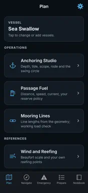
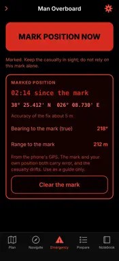
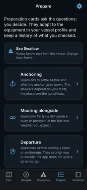
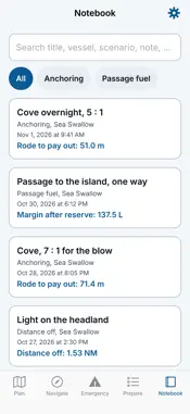
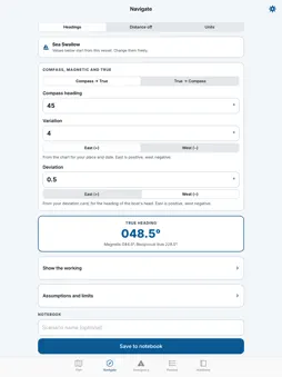
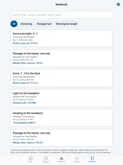
Maritime Toolkit is a planning workspace for your own boat. Enter your vessel once, and every tool starts from its length, draft, bow roller height, rode, fuel and burn rate. PLAN - Anchoring Studio: depth from the sounder or from chart plus tide, scope ratio of your choice, rode to pay out, the swing circle drawn to scale, keel clearance at the lowest level, and the same conditions at other scopes side by side. - Passage Fuel: distance, speed, current each way and your own reserve policy (percent, fixed volume or hours). Shows the margin after reserve, one-way range and out-and-back radius. - Mooring Lines: line lengths from the geometry and a working load check. - Wind and Reefing: the Beaufort scale and your own reefing points. - Rope for the Job: fibres, stretch and what each suits. NAVIGATE - Compass, magnetic and true headings, with variation and deviation entered as East or West so a minus sign is never needed. Optional deviation card for your boat. - Distance off by vertical angle, with the reference level and tide corrections shown. - Unit converter. EMERGENCY (free, works with no signal) - Man overboard: one tap saves your phone's position and the time, then shows time since the mark, bearing and range back to it. - MAYDAY and PAN-PAN scripts to read from, filled in with your vessel details and position. - Sound signals for Rules 34 and 35, with blast patterns. - The collision rules in brief and the distress signals. - Emergency preparation checklist. PREPARE - Preparation cards for anchoring, mooring, departure, reduced visibility, heavy weather and emergencies. They ask the questions, you decide, and they adapt to the equipment in your vessel profile. NOTEBOOK - Save calculations with a scenario name, search them, compare two entries and export a PDF in Letter or A4. SHOWS ITS WORKING Every result comes with the steps and the assumptions behind it, so you can check it. DISPLAY MODES Day, Sunlight (high contrast for a bright cockpit) and Red night (red on black to keep your night vision). PRIVATE No account and no analytics. Everything is stored on your device. Location is used only while the app is open, to show your position and your range to a man overboard mark. It is never sent anywhere. FREE AND ONE-TIME UNLOCK The emergency tab, the anchoring studio, the preparation cards for anchoring and emergencies, one vessel profile, wind and reefing, the rope guide and five saved calculations are free. A single one-time unlock adds passage fuel, the navigation tools, mooring lines, more preparation cards, several vessel profiles and an unlimited notebook with comparison and PDF export. There is no subscription. IMPORTANT Maritime Toolkit is a planning and reference aid. It does not replace certified navigation equipment, official charts and publications, the collision regulations, your equipment manuals or the skipper's judgement. It does not send distress calls, does not contact rescue services and does not monitor for emergencies. Use your radio, beacon or phone to call for help. Check every figure against what you can see and measure.
What's New
Version 2.0.0 2026-11-02
Maritime Toolkit is now a planning workspace for your boat, not a list of separate calculators. • Set up your vessel once. Length, draft, bow roller height, ro... Technical Analysis
Package Overview Basic metadata
Bundle ID
com.talordigitals.toolkit Current Version 2.0.0
Minimum iOS 17.0
Package Size App Store Size
Package Metadata 0 / 0 version records
Detailed binary, privacy manifest, framework, and Info.plist results have not been indexed for this package yet. The verified App Store and archive metadata above remains available.
Developer Information
Known Version Records
0 version records with stored package metadata
Stored metadata does not guarantee a package is currently available to download.
| Details | Version / IDs | Version date | Action |
|---|