
Preview




Description
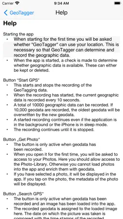
GeoTagger is an easy-to-use tool that can be used to enrich photos with geo or GPS data. Simply start GeoTagger during an excursion and record the geo data during the excursion. After the excursion the photos can be conveniently and automatically enriched with the corresponding geo-data. A total of 10,000 geodata can be recorded with GeoTagger. This is usually enough to be able to add geo-data to all trips of a 3 - 4 week vacation. In addition, the metadata of the loaded photo can be displayed via GeoTagger.
What's New
Version 1.1.1 2025-05-06
Minor bug fixes Technical Analysis
Package Overview Basic metadata
Bundle ID
de.dsjdatentechnik.geotagger Current Version 1.1.1
Minimum iOS 17.0
Package Size App Store Size
Package Metadata 0 / 3 version records
3.0 / 5.0 (1 ratings)
Detailed binary, privacy manifest, framework, and Info.plist results have not been indexed for this package yet. The verified App Store and archive metadata above remains available.
Known Version Records
0 version records with stored package metadata • 3 known version records
Stored metadata does not guarantee a package is currently available to download.
| Details | Version / IDs | Version date | Action |
|---|---|---|---|
| Not archived | App Store ID: 874527809 | Unknown | Paid / Arcade |
| Not archived | App Store ID: 844466351 | Unknown | Paid / Arcade |
| Not archived | App Store ID: 835914914 | Unknown | Paid / Arcade |