
Preview




Description
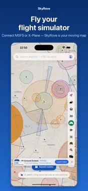
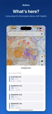
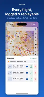
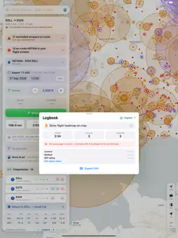
SkyRove is a free VFR flight-planning app and pilot community, built by a student pilot who wanted a genuinely open, no-strings tool for planning and sharing GA flights. Plan a route in seconds, check it against controlled airspace and terrain, brief the airfields at both ends, then fly it with a moving map — and afterwards, log the flight and share the journey with other pilots. PLAN YOUR FLIGHT • Tap-to-route planning with instant distance, heading and time • True magnetic headings from the World Magnetic Model • Controlled-airspace warnings along your route and at your cruising level • Interactive terrain profile so you can see clearance at a glance • Live NOTAMs and METAR/TAF weather for your airfields • Wind, cloud and rain overlays BRIEF ANY AIRFIELD • Runways, frequencies, elevation and circuit information • Sunrise, sunset and last-light times • Approach plates where available • Live arrivals and departures at larger airports FLY IT • Full-screen moving map with your aircraft position • Follow mode from brakes-off to shutdown • Automatic airborne and landing detection LOG AND REPLAY • Every flight logged automatically with track, distance and time • Import your existing logbook, including SkyDemon flight logs • Replay any flight with granular playback controls • Flight heatmap of everywhere you have flown SHARE WITH THE COMMUNITY • Publish your journeys with the route and story behind them • Follow other pilots and discover their flights • Swap tips, ask questions and find fly-ins • Build up a directory of airfields the community actually uses FREE FOREVER SkyRove is free and always will be. There are no subscriptions, no adverts and no locked features. If you find it useful, you can support it with a small donation — but you never have to. IMPORTANT SkyRove is an aid to flight planning and situational awareness. It is not certified for navigation and must not be used as your primary means of navigation. Always carry current official charts and publications, and check NOTAMs and weather from official sources before every flight.
What's New
Version 1.1.16 2026-11-07
More honest planning. • The Brief's Weather check now includes cloud along your route, not just at the airfields • Hazard fixes only suggest a climb or descent...More honest planning. • The Brief's Weather check now includes cloud along your route, not just at the airfields • Hazard fixes only suggest a climb or descent that actually takes you clear; if you meet a zone while climbing out, it tells you who to call instead • Automatic routes go round ATZs and MATZs when the detour is small, and otherwise tell you who to call, with one tap to switch • The co-pilot never offers a route through airspace you can't enter, and flags any stretch below the safety altitude (such as the Manchester Low Level Route) • In flight, only the NOTAMs at your level and near your route are shown • Turning points are named after nearby places, and repeated radio calls are merged Technical Analysis
Package Overview Basic metadata
Bundle ID
uk.co.skyrove.app Current Version 1.1.16
Minimum iOS 17.0
Package Size App Store Size
Package Metadata 0 / 0 version records
Detailed binary, privacy manifest, framework, and Info.plist results have not been indexed for this package yet. The verified App Store and archive metadata above remains available.
Developer Information
Known Version Records
0 version records with stored package metadata
Stored metadata does not guarantee a package is currently available to download.
| Details | Version / IDs | Version date | Action |
|---|